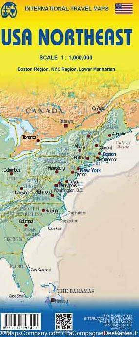
Travel map - USA Northeast (Northern Maine in Virginia) | ITM
Regular price
$11.00
Regular price
$16.00
Sale price
$11.00
Save $5
/
- Shipping within 24 working hours from our warehouse in France
- Delivery costs calculated instantly in the basket
- Free returns (*)
- Real-time inventory
- Low stock - 2 items left
Related geographic locations and collections: East Coast of the United States, Maine, New England, New York (state), Ohio, Virginia, West Virginia