Carte routière de l'Alberta et de la Saskatchewan | Canadian Cartographics Corporation carte pliée Canadian Cartographics Corporation

Alberta and Saskatchewan Road map | Canadian Cartographics Corporation

Price
Regular price $9.00
Regular price Sale price $9.00
Save $-9
/
  • Shipping within 48 business hours from our warehouse in the USA. For this product, customs fees may be requested by the carrier upon delivery.
  • Delivery costs calculated instantly in the basket
  • Free returns (*)
  • Real-time inventory
  • In stock, ready to ship
  • Backordered, shipping soon
Tax included.

Often purchased together:

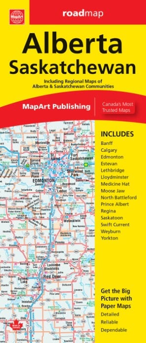
Alberta, including the Banff and Jasper National Parks, and Saskatchewan on an indexed road map presenting both provinces at 1:1,850,000, each accompanied by several street maps of their main cities, including detailed plans of downtown Calgary, Edmonton, Regina and Saskatoon.
On one side is a road map of Alberta with coverage extending within British Columbia to Kelowna, plus street plans of Calgary and Edmonton at 1:250,000 with their downtown areas in more detail at 1:25,000, plus street maps of Red Deer, Lethbridge, Medicine Hat and Banff. On the reverse, a road map of Saskatchewan comes with street plans of Regina and Saskatoon at 1:100,000 with their downtown districts at 1:25,000, plus plans of Swift Current, Lloydminster, Yorkton, Moose Jaw, Prince Albert, Battleford/North Battleford, Estevan and Weyburn.
On the road maps at 1:1,850,000 the base prominently highlights numerous national and provincial parks. Topography is shown spot heights; numerous rivers are also named. R


ISBN/EAN : 9781554862344
Publication date: 2023
Folded dimensions: 9.45 x 3.94 inch / 24 x 10cm
Unfolded dimensions: 39.37 x 27.17 inches / 100 x 69cm
Language(s): English
Weight: 2.1 oz

Customer Reviews

Be the first to write a review
0%
(0)
0%
(0)
0%
(0)
0%
(0)
0%
(0)