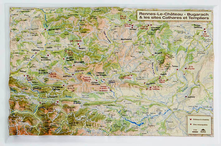
Small relief map - Rennes-Le-Chateau Bugarach - 27 x 22.5 cm
Regular price
$18.00
Regular price
Sale price
$18.00
Save $-18
/
- Product on order - Shipping within 5 to 8 working days from our warehouse in France
- Delivery costs calculated instantly in the basket
Related geographic locations and collections: 3D Raised-Relief Maps, Cathar