Alsace Hiking guide published by rother with 50 beautiful hiking descriptions.
152 pages, 86 color photos, 50 maps 1: 50.000 and 1:75 000, 1 synoptic map
Editor's note:
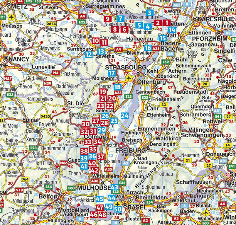
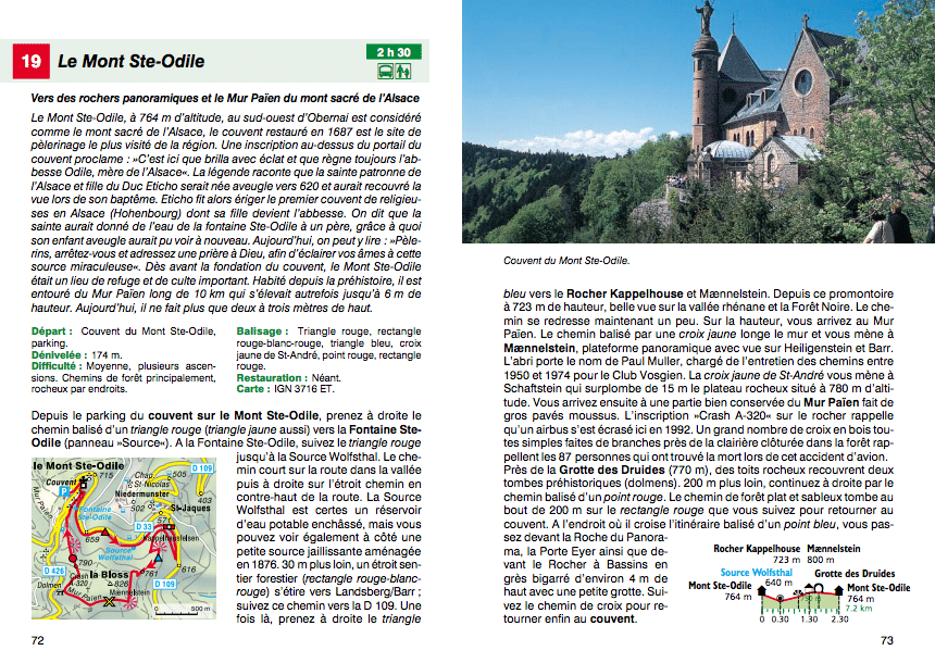
"Which magnificent garden", would have exclaimed, delighted, the Sun King Louis XIV during his journey through Alsace. Chestnuts and figs ripen here thanks to the sweetness of the climate. The floral half - timbered houses, the stork nests on the steeples, the vineyards as far as the eye can see, the castles on wooded heights, the welcoming taverns and the bite parties are reminiscent of the southern regions. Even the nearby Vosges, to which a guide is devoted in the same edition, mark their imprint the Alsatian landscape. 50 half - day hikes and a day in everything browse this charming region in eastern France where family - friendly routes are also addressing lovers of nature and culture. Alsace can be visited virtually any season. In the spring, the sweet green of forests and fruit trees in bloom attract tourists. In summer, you can walk through the flooded vineyards of sun and shaded forests on the edge of the Vosges. In autumn, vineyards and trees take their multicolored coat and clear days promise a magnificent panorama from the many points of view. In November, when it's cold, we advise you excursions in villages and towns. In the Sundgau in particular, the southern part of Alsace, it is possible to magnificently associate the pleasures of the mouth hiking in a picturesque landscape on the "road of carpe fried". On the edge of the Route des Sinue Alsace wines through the vineyards on 170 km between Marlenhaim north to Thann south, many interesting hikes are available to you: Upper Koenigsbourg for example, the Larger and most famous of the castles of Alsace, is visited by many tourists while orchids and butterflies attract enthusiasts of nature on the dry lawns of the Bollenberg. North of Alsace finally stretching between the German border, the Rhine, the Northern Vosges and Strasbourg, offers a large number of beautiful hikes, in the forest for example, as well as in the fluvial meadows of the Rhine who houses a multitude of species. Each of the hikes presented in this guide by the authors and journalists Barbara Christine and Jörg - Thomas Titz includes a brief description containing the main information, a detailed description of the itinerary as well as a small map with the route of the course and a Informative altitude profile. Many color photos make you discover all the facets of Alsace.