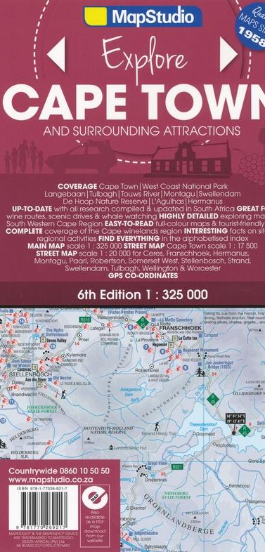
Road Atlas - CAP in Port Elizabeth | MapStudio
Road Atlas - CAP in Port Elizabeth | MapStudio
Regular price
$33.00
- Shipping within 24 working hours from our warehouse in France
- Delivery costs calculated instantly in the basket
- Free returns (*)
- Real-time inventory
Related geographic locations and collections: Cape Town, South Africa, Travel atlas