Carte du Cap & environs (Afrique du Sud) | MapStudio carte pliée MapStudio
Carte du Cap & environs (Afrique du Sud) | MapStudio - La Compagnie des Cartes
Carte du Cap & environs (Afrique du Sud) | MapStudio carte pliée MapStudio

Cape Town Map & Surroundings (South Africa) | MapStudio

Cape Town Map & Surroundings (South Africa) | MapStudio

Regular price $17.00
/
  • Shipping within 24 working hours from our warehouse in France
  • Delivery costs calculated instantly in the basket
  • Free returns (*)
  • Real-time inventory
  • In stock, ready to ship
  • Backordered, shipping soon
Tax included.
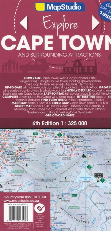
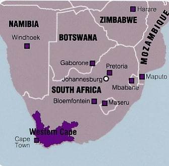
This detailed Road map covers the Cape region with Western Cape, Overberg and Winelands. The cover includes Cape Town, West Coast, Cape Town Viniculture, Breess River Valley, Overberg, Track 43, Boland, Hex River Valley, Swartland, Whale Road, Highway 62. cities including Stellenbosch Franschhoek Paarl Wellington Hermanus Somerset West Strand Montagu Robertson Swellendam WORCSTER CERES Tulbach and Cape Town CBD.
This map includes a detailed map for panoramic roads from each region, as well as a city index, 6 large attractions and a wine - building index. Scale 1/325 000 (1 cm = 3.25 km) and 1/20 000 (1 cm = 200 m).


ISBN/EAN : 9781770269217
Publication date: 2017
Scale: 1/325,000 (1cm=3.25km) & 1/20,000 (1cm=200m)
Printed sides: both sides
Folded dimensions: 25x13cm
Unfolded dimensions: 100 x 69cm
Language(s): English
Poids : 70 g

Customer Reviews

Based on 2 reviews
100%
(2)
0%
(0)
0%
(0)
0%
(0)
0%
(0)
C
Christine C. (Chateau-Gaillard, FR)
Parfait

Service rapide

C
Client S.
Pouvoir trouver un tel produit est ...

Pouvoir trouver un tel produit est déjà un exploit. Qualité des cartes irréprochable