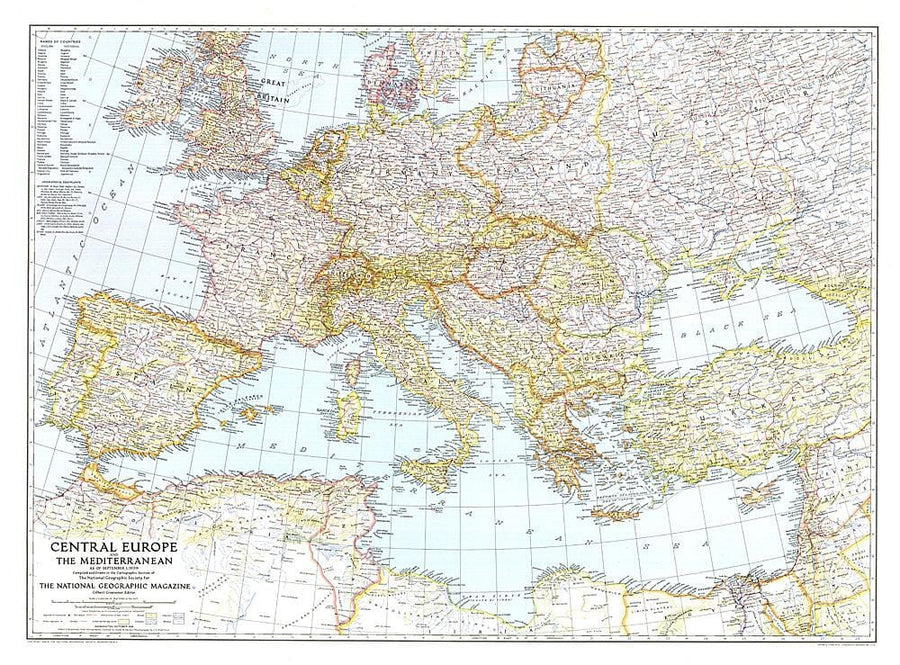
1939 Central Europe and the Mediterranean Map
1939 Central Europe and the Mediterranean Map
Regular price
$47.00
- Ships within 48 business hours from our US warehouse.
- Delivery costs calculated instantly in the basket
- Free returns (*)
- Real-time inventory
- In stock, ready to ship
Related geographic locations and collections: Europe, Europe Wall Maps, National Geographic Historic - Print on Demand, Wall Maps