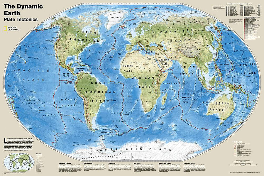
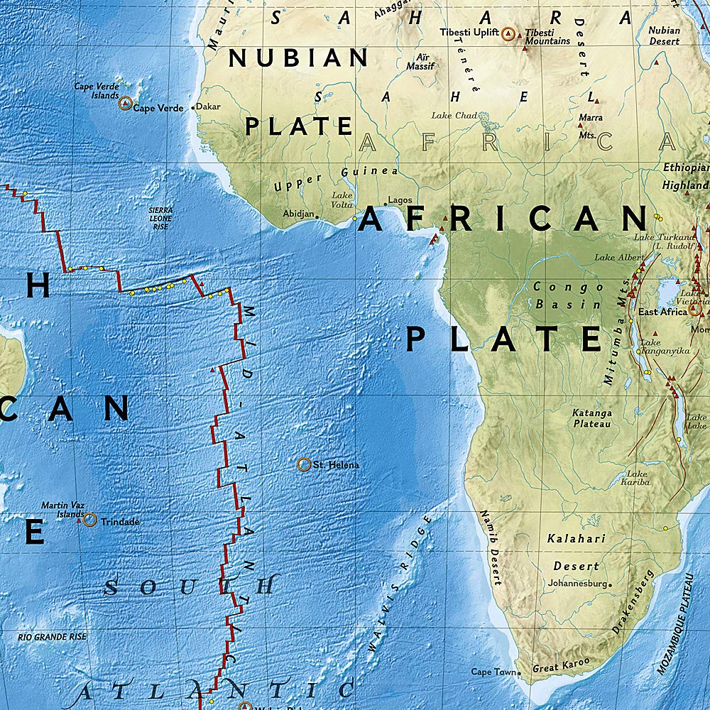
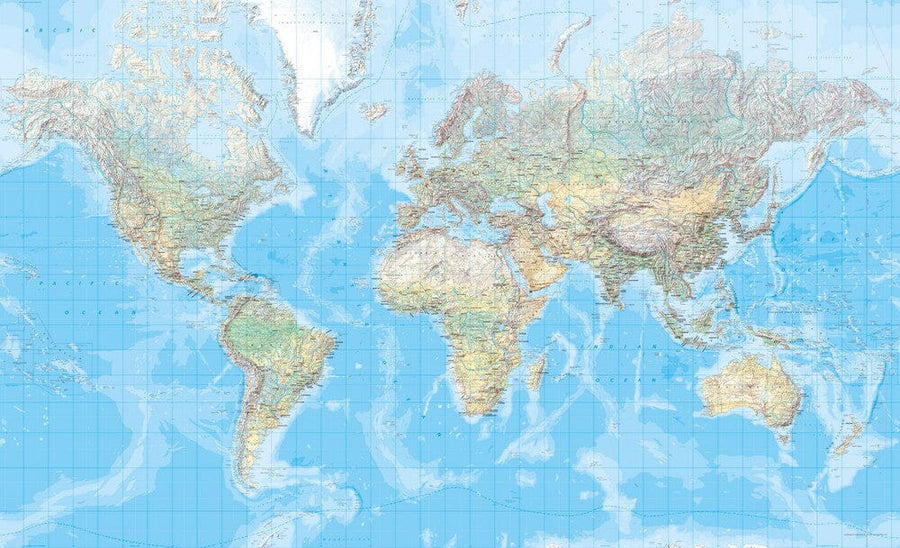
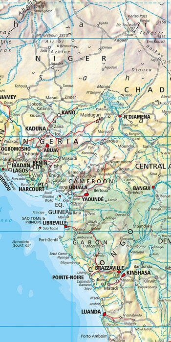
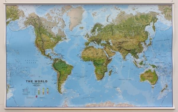
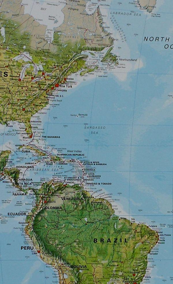
Carte murale (en anglais) - Terre dynamique - Tectonique des plaques | National Geographic carte murale petit tube National Geographic Papier
Carte murale (en anglais) - Terre dynamique, Tectonique des plaques - 92 x 61 cm | National Geographic carte murale petit tube National Geographic
Carte murale (en anglais) - Terre dynamique - Tectonique des plaques | National Geographic carte murale petit tube National Geographic Plastifiée
Carte murale (en anglais) - Terre dynamique, Tectonique des plaques - 92 x 61 cm | National Geographic carte murale petit tube National Geographic

Wall Map (in English) - dynamic earth, plate tectonics - 92 x 61 cm | National Geographic

Wall Map (in English) - dynamic earth, plate tectonics - 92 x 61 cm | National Geographic

Finishing
Regular price $34.00
/
  • Shipping within 7 to 10 working days from our warehouse in France
  • Delivery costs calculated instantly in the basket
Tax included.

The dynamic land map illustrates the tectonics of the plates and has an astonishing bathymetry and a natural color relief, as well as data on volcanoes and earthquakes until 2011.
as pieces of a giant puzzle Tectonic plates fit together to form the external hull of the Earth. The interaction of these plates causes earthquakes and volcanoes and shapes the earthly crust in mountains, valleys and trenches. The dynamic land map illustrates 17 large tectonic plates and highlights the limits of diffuse plates, convergent boundaries, propagation limits, areas of faults, hot spots, notable earthquakes and volcanic eruptions of the 20th and early 21st. Century, and significant volcanic eruptions over the last 10,000 years.
Delivered in a laminated protection tube.
Available in paper version or laminatedized.

Note: For the laminated map, an additional time of a few days may be necessary for laminating.


Date de publication : 2017
Echelle : 1/45,000,000 (1cm=450km)
Impression: front
Dimensions déplié(e) : 92 x 61cm
Langue : English

Customer Reviews

Based on 2 reviews
100%
(2)
0%
(0)
0%
(0)
0%
(0)
0%
(0)
G
Geneviève P. (Bordeaux, FR)
Complémént pour un bon atlas

Belle qualité .
Difficile ,toutefois à installer en l'état : il faut la "mettre sous presse"
pendant quelques jours pour l'aplatir et réduire son effet cylindre.

G
Geneviève P. (Mérignac, FR)
Bonne initiation

Accompagnée d'un bon atlas, la carte donne une vue de la terre physique claire et documentée.