Scenic road trips of Wisconsin and Michigan | MAD Maps carte pliée

Scenic Road Trips in Wisconsin and Michigan | MAD Maps

Price
Regular price $17.00
Regular price Sale price $17.00
Save $-17
/
  • Shipping within 48 business hours from our warehouse in the USA. For this product, customs fees may be requested by the carrier upon delivery.
  • Delivery costs calculated instantly in the basket
  • Free returns (*)
  • Real-time inventory
  • In stock, ready to ship
  • Backordered, shipping soon
Tax included.

Often purchased together:

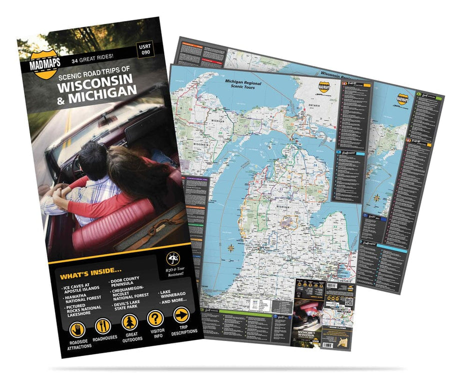
The Wisconsin and Michigan Road Trip Planner: Offers a map of Wisconsin and a map of Michigan, showcasing the best of the region via 34 road trips. Looking for day trips or weekend getaways? Local scouts showcase highways and scenic drives, plus the best places to stop along the way. They've discovered magnificent natural wonders: Tahquamenon Falls; Manistee National Forest; Wilderness State Park; Silver Lake State Park; Pictured Rocks National Lakeshore; Isle Royale National Park; Alger Falls; Craig Lake State Park; and Mackinac Island State Park. The Upper Midwest offers a charm unlike any other region in the country, showcased in 34 road trips. MAD Maps' road trip maps are available as traditional paper maps, as well as iPhone and Android maps. MAD Maps USA Road Trip Features: *Scenic Day & Overnight Drives *24-35 Trip Options Per Map with Directions *Convenient Pocket Size: 4" x 9" - FOLDED *Color-Coded Routes *Water & Tear Resistant Paper *Route Hand-Selected by Local Scouts*


ISBN/EAN : 9781934955000
Publication date: 2020
Folded dimensions: 22 inches x 10 inches (55 x 25 cm)
Unfolded dimensions: 25.59 inches x 34.25 inches (64 x 86 cm)
Language(s): English
Weight: 3.0 oz

Customer Reviews

Be the first to write a review
0%
(0)
0%
(0)
0%
(0)
0%
(0)
0%
(0)