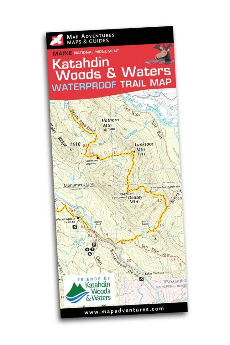
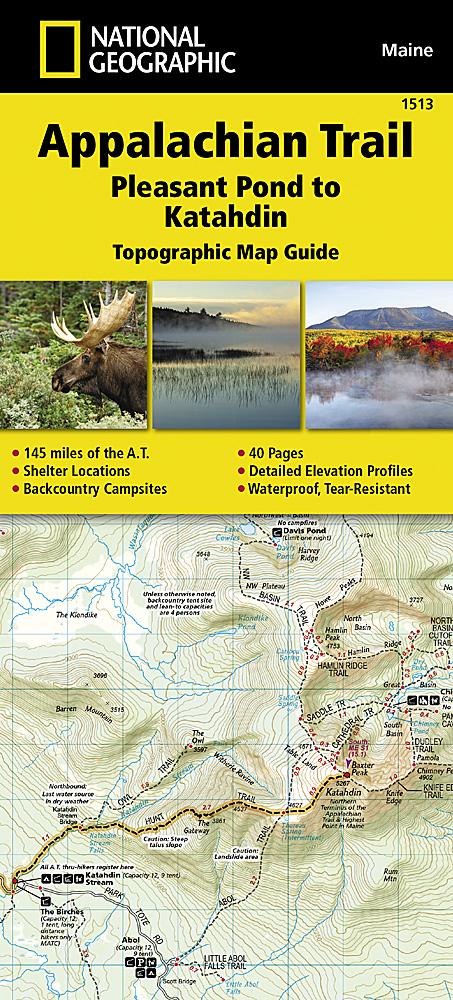
Katahdin Woods & Waters National Monument Trail Map | Map Adventures
Regular price
$12.00
Regular price
Sale price
$12.00
Save $-12
/
- Shipping within 48 business hours from our warehouse in the USA. For this product, customs fees may be requested by the carrier upon delivery.
- Delivery costs calculated instantly in the basket
- Free returns (*)
- Real-time inventory
- Low stock - 2 items left
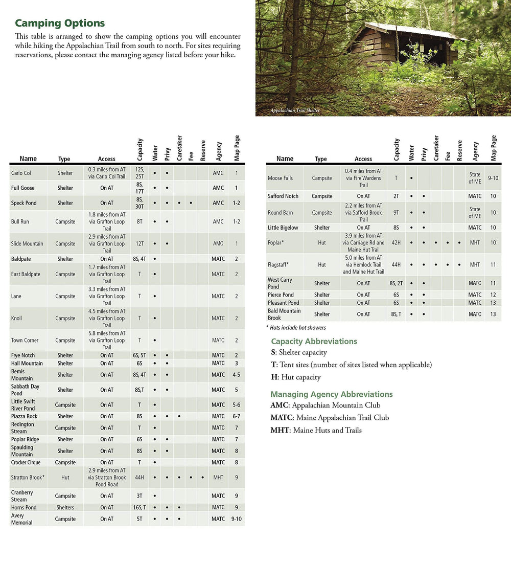
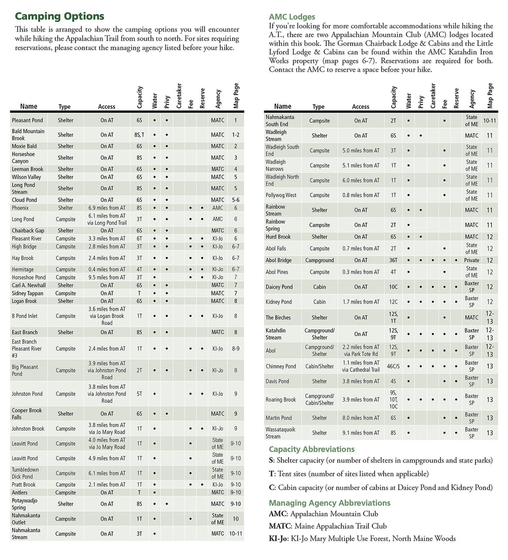
Related geographic locations and collections: Maine