Iran wall map laminated | National Geographic Wall Map (small tube)

Iran Wall map laminated | National Geographic

Price
Regular price $32.00
Regular price Sale price $32.00
Save $-32
/
  • Shipping within 48 business hours from our warehouse in the USA. For this product, customs fees may be requested by the carrier upon delivery.
  • Delivery costs calculated instantly in the basket
  • Free returns (*)
  • Real-time inventory
  • In stock, ready to ship
  • Backordered, shipping soon
Tax included.

Often purchased together:

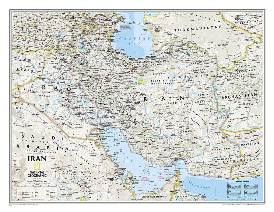
National Geographic's political map of Iran is one of the most authoritative and detailed maps available for this country that is heir to one of the world's oldest civilizations. This Classic style Wall map features a bright color palette and stunning shaded relief that has been a hallmark of National Geographic maps for over 75 years. Thousands of place names, accurate political boundaries, national parks, mountain peaks and passes, swamps, deserts, lava fields, dry lakes and major infrastructure networks such as highways and roads, airports, railroads, oil fields and pipelines, and canals are detailed. Significant bodies of water, such as the Persian Gulf, Caspian Sea and Strait of Hormuz are shown with coastal bathymetry using depth curves and soundings. Coverage also includes Iraq, Qatar, Kuwait, Bahrain and parts of Syria. Saudi Arabia, UAE, Oman, Pakistan, Afghanistan, Uzbekistan, Turkmenistan, Azerbaijan and Armenia.


ISBN/EAN : 9781597753708
Publication date: 2010
Folded dimensions: 77 x 60cm / 30.31 x 23.62in
Language(s): English
Weight: 322 g

Customer Reviews

Be the first to write a review
0%
(0)
0%
(0)
0%
(0)
0%
(0)
0%
(0)