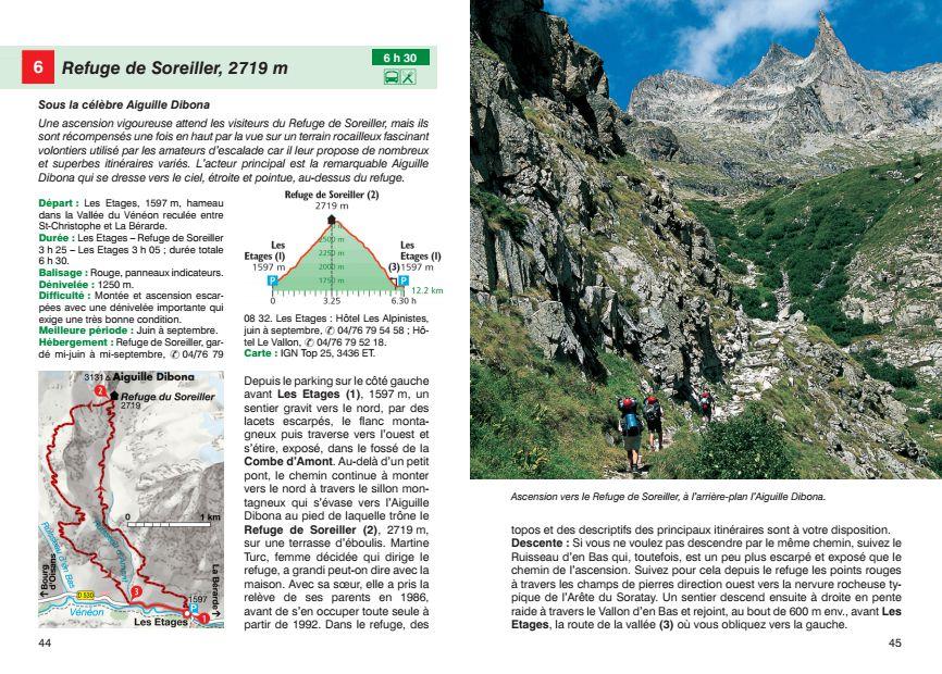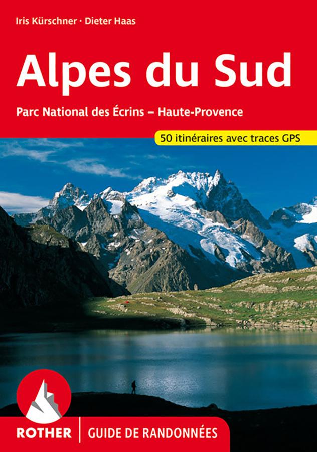


Hiking guide - South Alps: Ecrins National Park, Haute Provence | Rother (French)
Regular price
$21.00
Regular price
Sale price
$21.00
Save $-21
/
- Shipping within 24 working hours from our warehouse in France
- Delivery costs calculated instantly in the basket
- Free returns (*)
- Real-time inventory
- Low stock - 1 item left
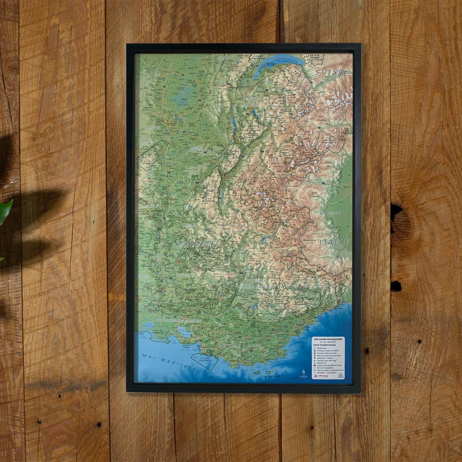
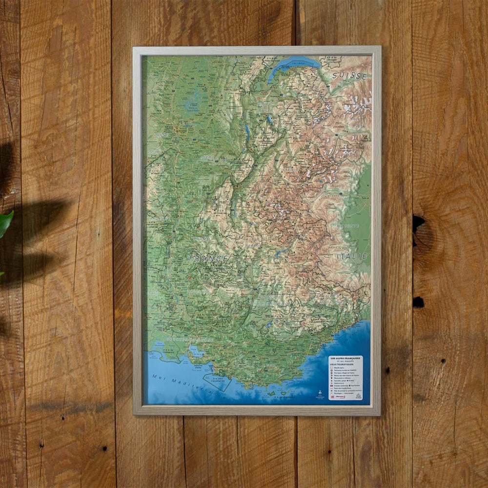
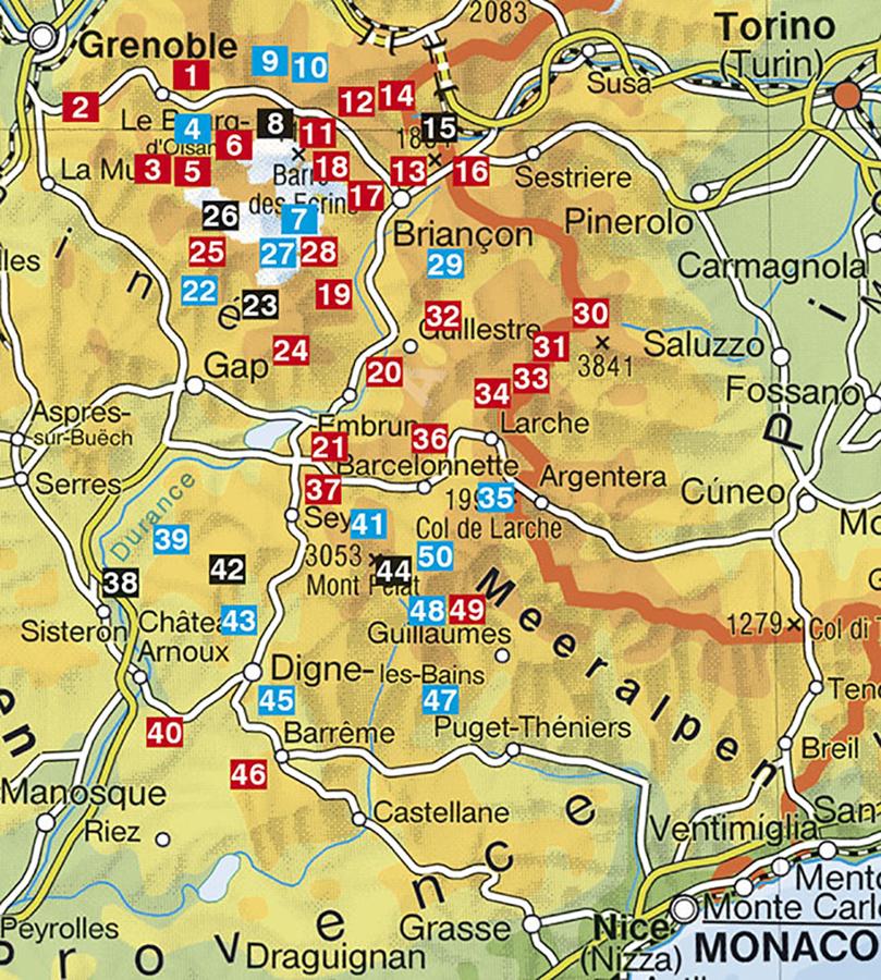
Related geographic locations and collections: Alpes-de-Haute-Provence (department 04), Alpes-Maritimes (department 06), Alps, Auvergne-Rhône-Alpes, Ecrins National Park, French Alps (all hiking), French Alps - Hiking guides, Hautes-Alpes (department 05), Isère (department 38), Southern French Alps, Travel guides & practical guides