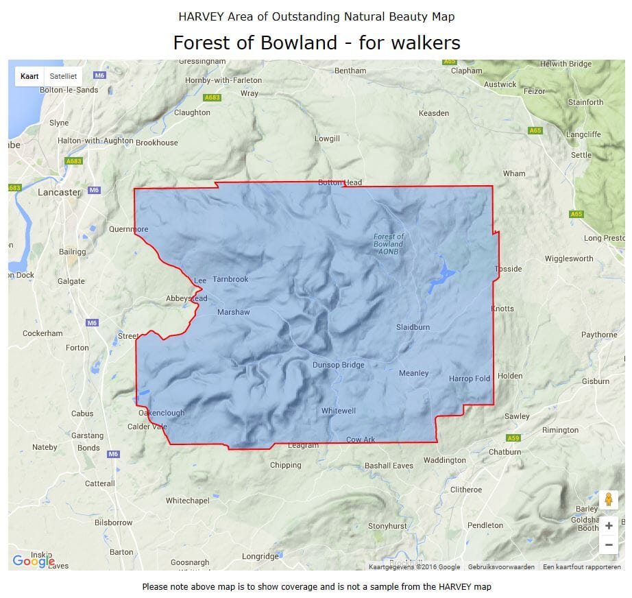
Carte de plein-air - Forest of Bowland | Harvey Maps carte pliée Harvey Maps

Outdoor Map - Forest of Bowland | HARVEY MAPS

Outdoor Map - Forest of Bowland | HARVEY MAPS

Regular price $23.00
/
  • Shipping within 24 working hours from our warehouse in France
  • Delivery costs calculated instantly in the basket
  • Free returns (*)
  • Real-time inventory
  • Low stock - 1 item left
  • Backordered, shipping soon
Tax included.
Special map for outdoor activities published by Harvey Maps.
Original description of the publisher:

This Map is 2-in-1. ON ONE SIDE IS A WALKING MAP On The Other A Map Suitable for Cyclists and Horseriders

The Forest of Bowland has a lot to offer Walkers, Horseriders and Cyclists, and this practical map Will Help You to Explore This Beautiful Part of England. The Map Gives, For the First Time, Detailed Information On How To Enjoy The Access Land On The High Fells of Bowland and All-Ability Routes in The Lowlands, France While The Shows The Whole of the Aonb in One Map - Perfect for Planisphere Longer Walks and Ride Distance. Forest of Bowland Area of ​​Outstanding Natural Beauty.

Includes Recommended Cycling Roads, Access Points, Rights of Way and Concessive Roads
Provids Information ON Facilities and Services
Clear and Easy to Read
The Map Can Be Used With GPS
Waterproof and bio-degradable.


ISBN/EAN : 9781851374731
Publication date: 2008
Scale: 1/25,000 (1cm=250m)
Folded dimensions: 11.6 x 24.3cm
Language(s): English
Poids : 82 g

Customer Reviews

No reviews yet
0%
(0)
0%
(0)
0%
(0)
0%
(0)
0%
(0)