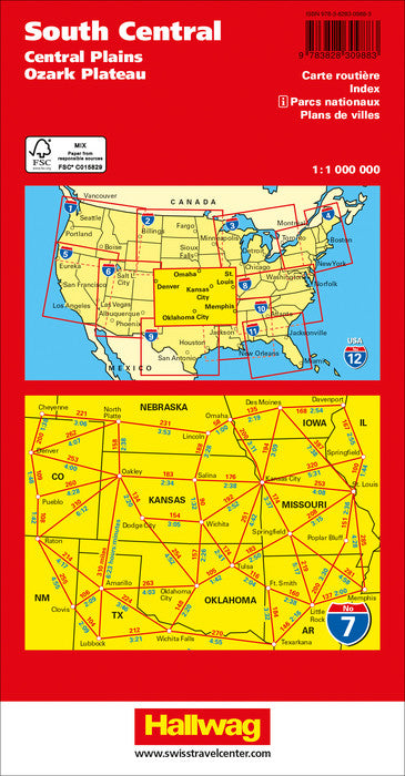
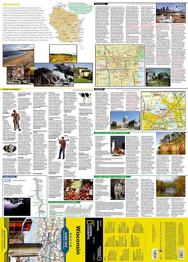
ISBN/EAN : 9783828309883
Publication date: 2022
Scale: 1/1,000,000 (1cm=10km)
Printed sides: front
Folded dimensions: 25 x 13 x 1.2cm
Unfolded dimensions: 138 x 100cm
Language(s): multilingual including French
Poids :
194 g
Road Map of the southern central United States published by Hallwag International. This map covers the central plains and the Ozark plateau. This road map runs from Omaha south of Oklahoma City (from north to south) and Denver to West Memphis in East) and includes Saint Louis.
In inset, the plans of denver agglomerations, Tulsa, Oklahoma City, Saint Louis, Branson, Memphis. Index of cities included.
Scale 1: 1,000,000 (1 cm = 10 km).
More from Midwest
Recently viewed