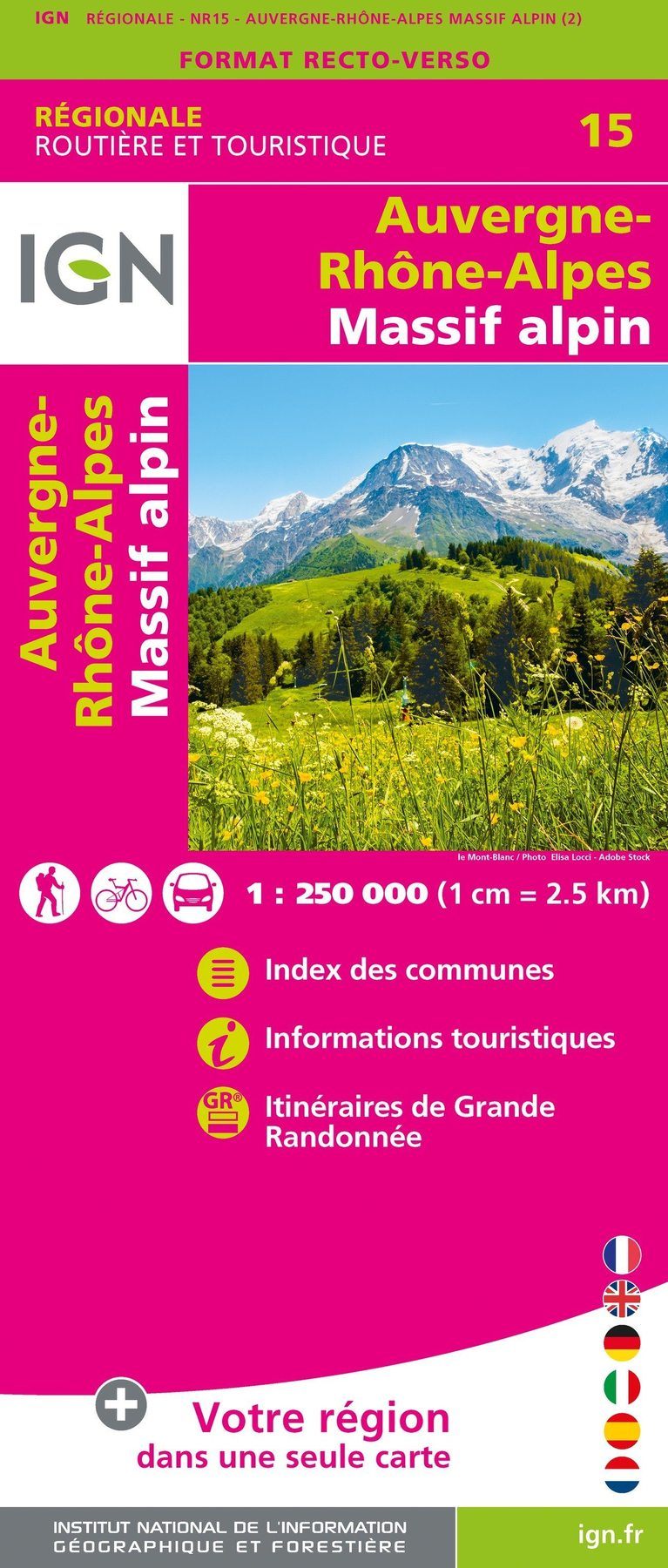
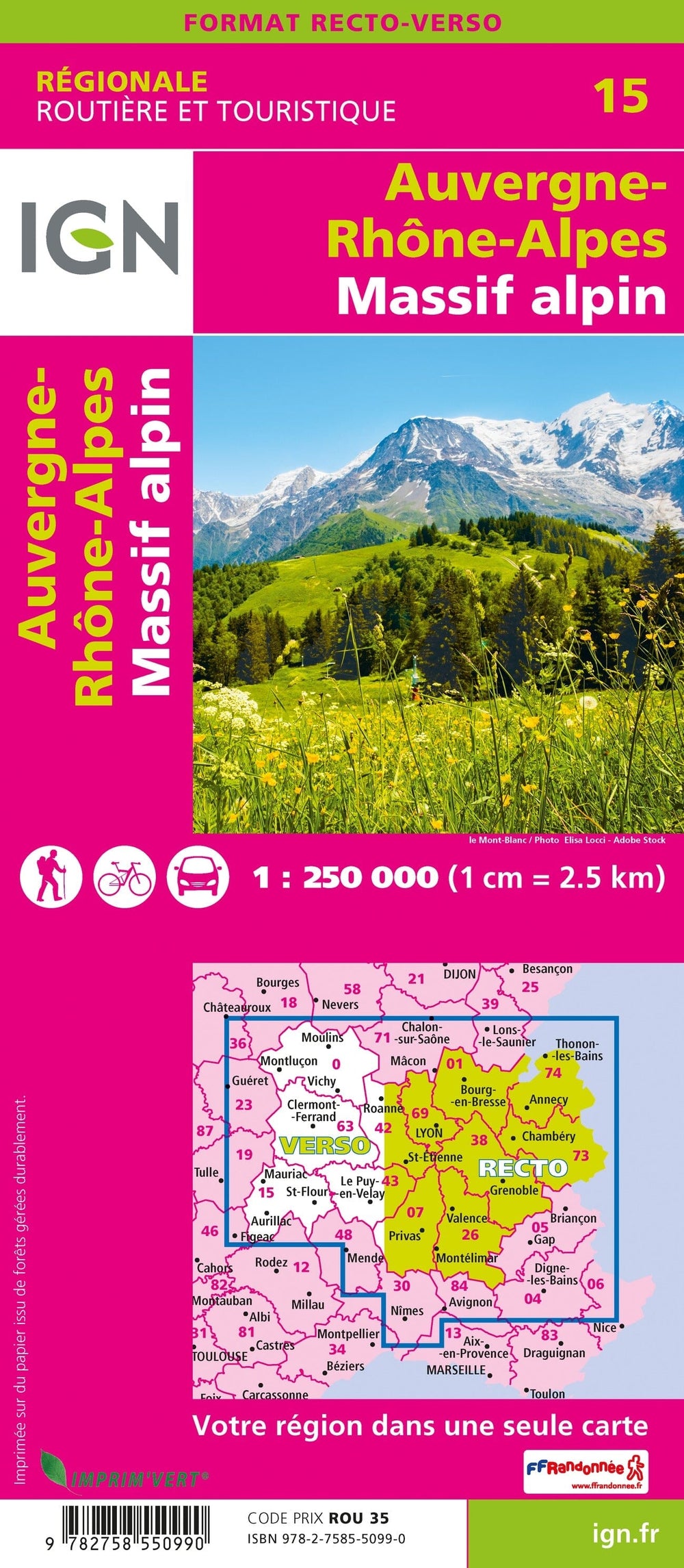
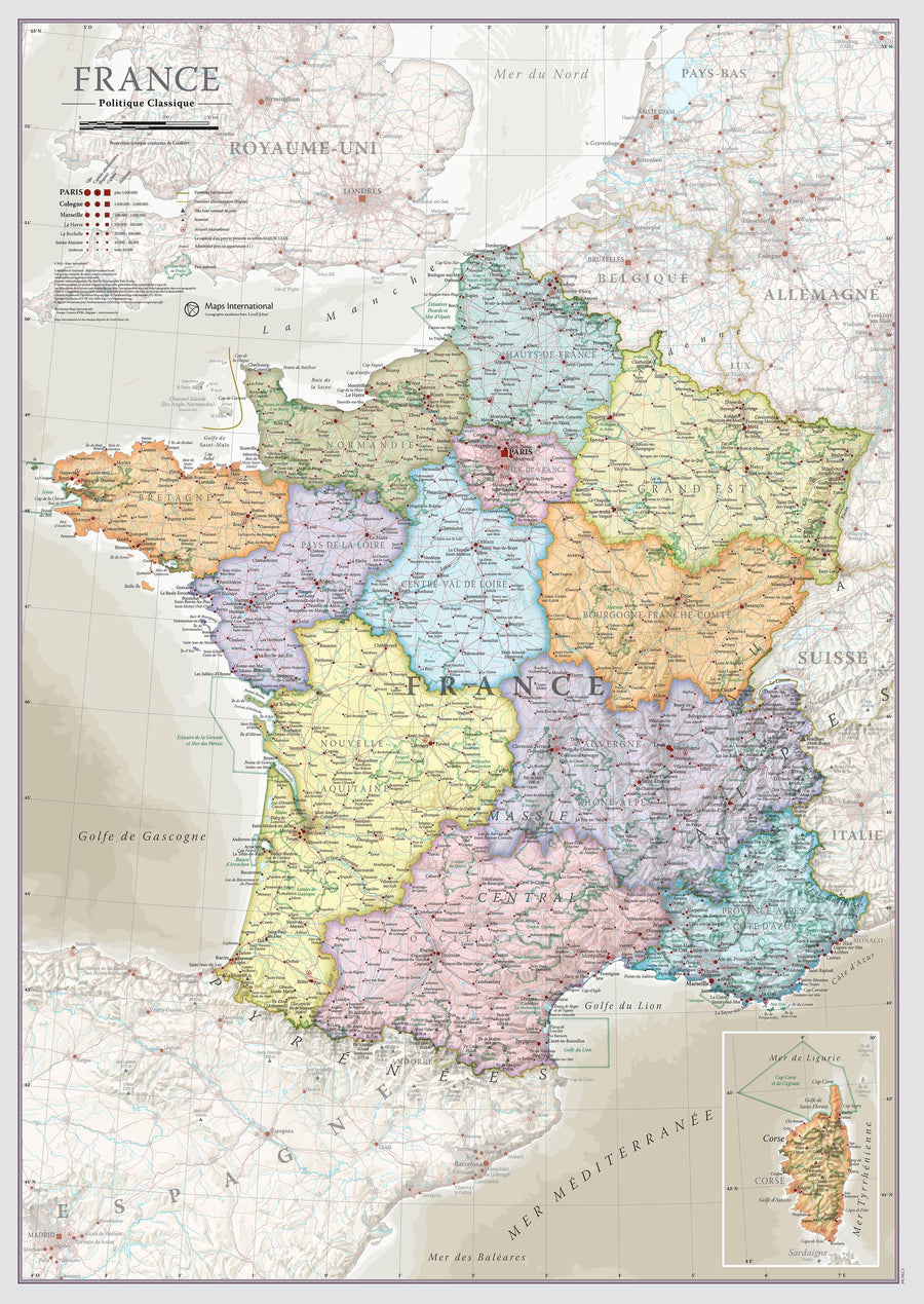
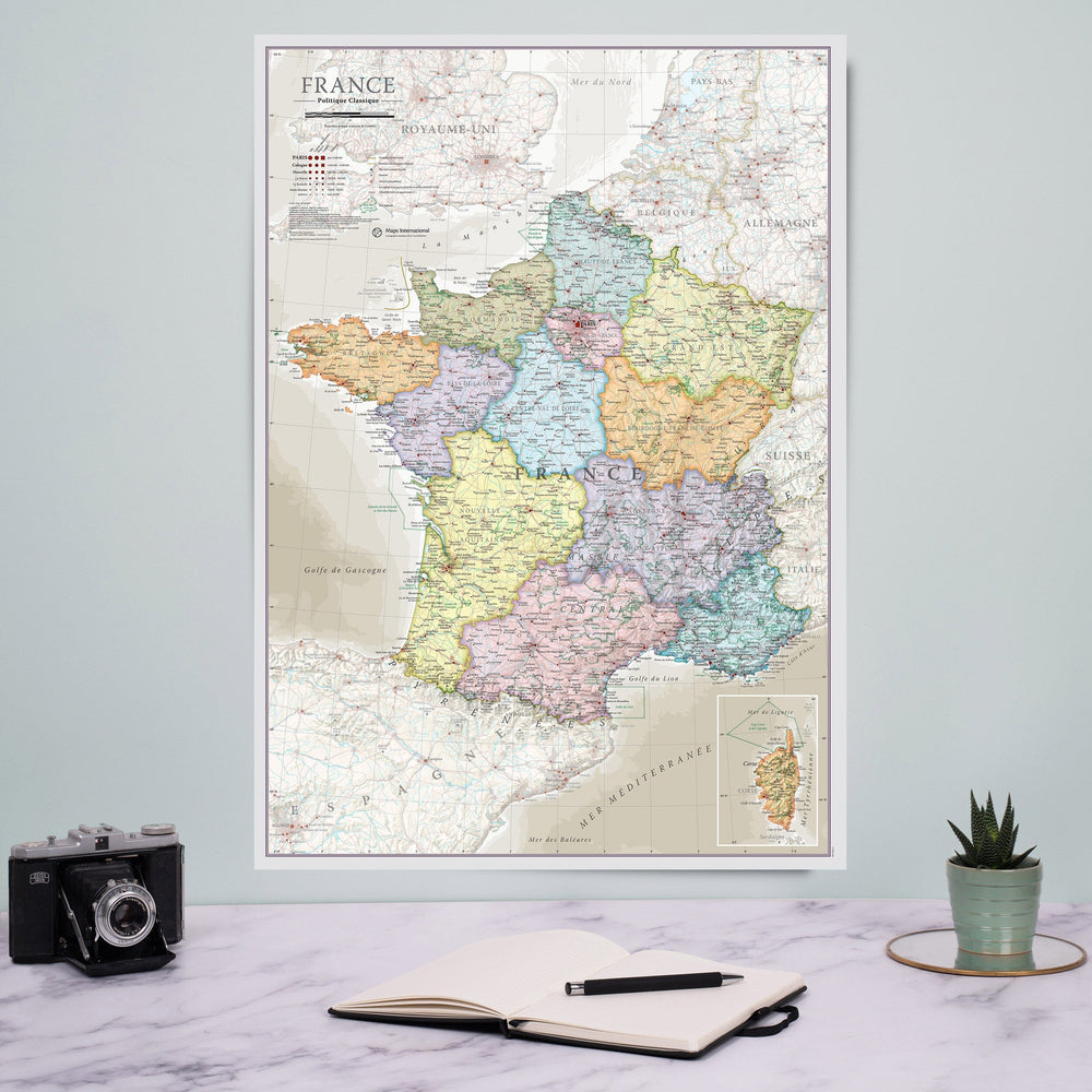
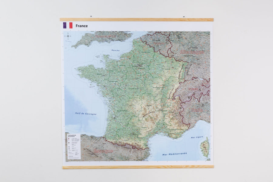
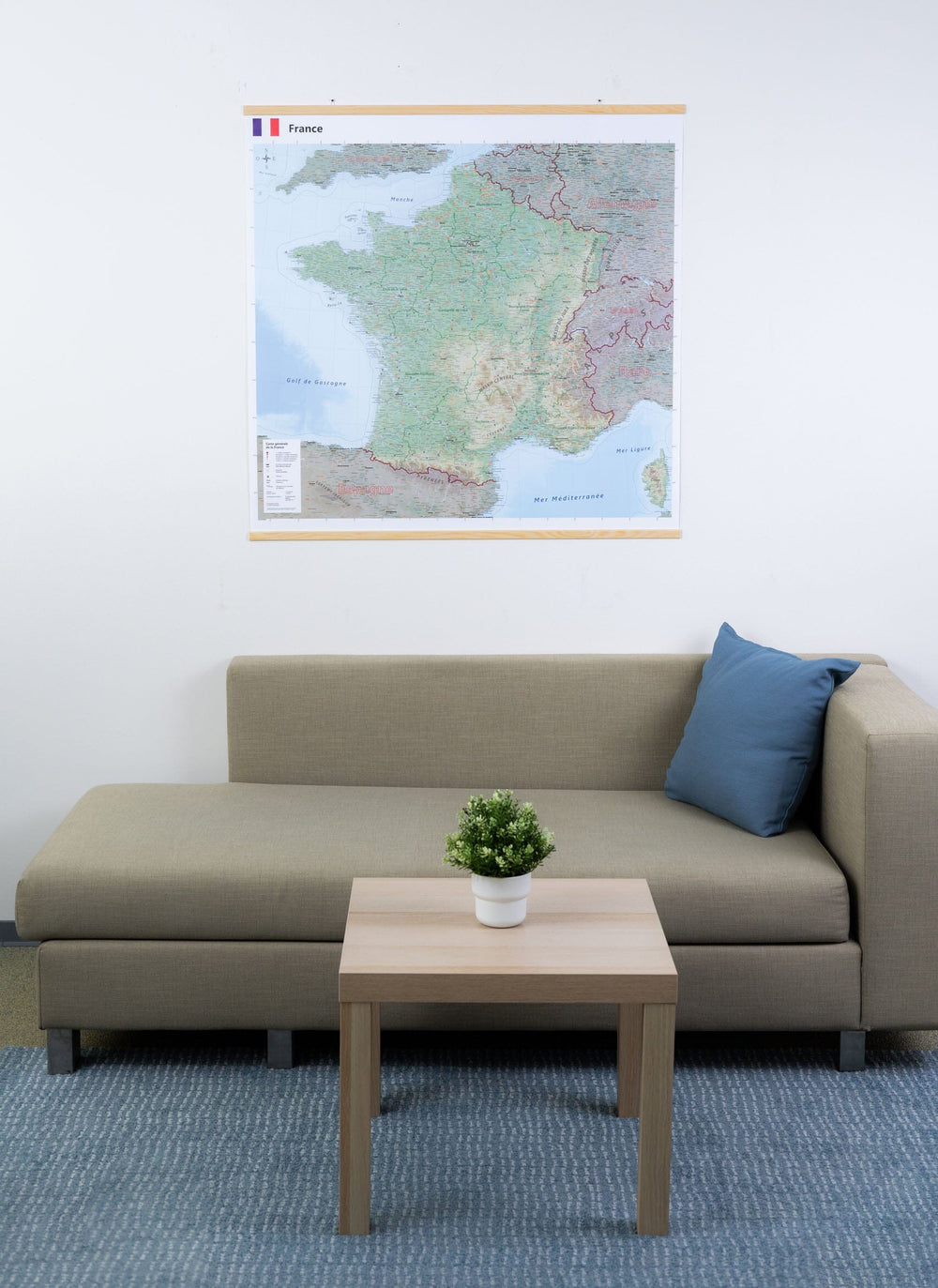
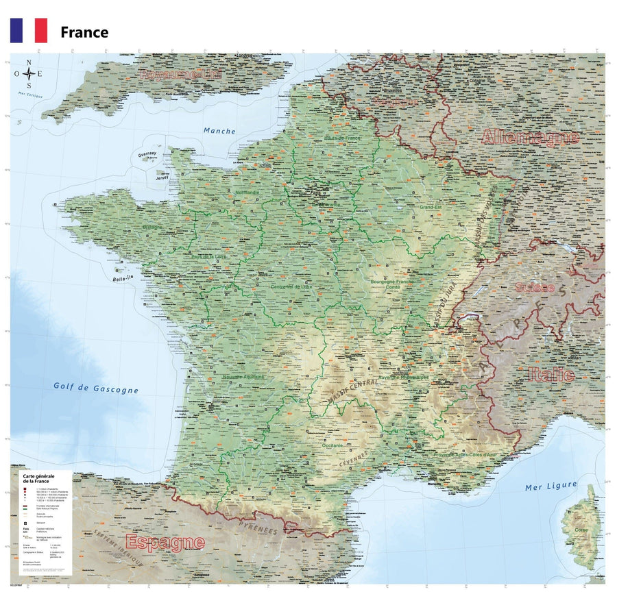
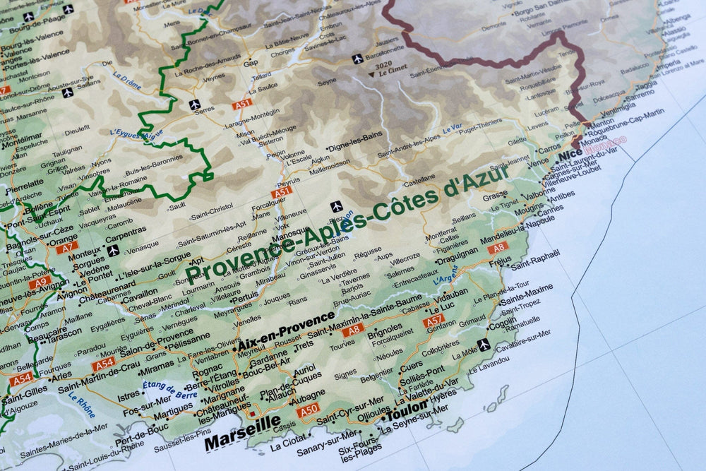
Carte régionale n° 15 : Auvergne - Rhône Alpes (Massif alpin) - VERSION MURALE ET PLASTIFIEE | IGN carte murale grand tube IGN
Carte régionale n° 15 : Auvergne-Rhône-Alpes - VERSION MURALE ET PLASTIFIEE | IGN carte murale grand tube IGN
Carte régionale n° 15 : Auvergne - Rhône Alpes (Massif alpin) - VERSION MURALE ET PLASTIFIEE | IGN carte murale grand tube IGN

Regional Map # 15: Auvergne-Rhône-Alpes - Laminated Wall Map | IGN

Regional Map # 15: Auvergne-Rhône-Alpes - Laminated Wall Map | IGN

Regular price $144.00
/
  • Product made to order - Shipping within 7 to 10 working days from our workshop
  • Delivery costs calculated instantly in the basket
Tax included.

This is a Verside Verster Post Full of the Regional Map IGN N ​​° 15 of the region Auvergne-Rhône-Alpes . Note:
- This map is assembled (front + verso) then flattened and laminatedized on demand, based on the Original map that is folded. The folds remain a little visible.

- The index is resumed on the map.
- The left part is a little higher compared to the right side, once the front and back assembled.
- The map is delivered rolled in a mapboard tube.

A delay of about 10 days is necessary for the manufacture of the map.

This product being made customized at the request of our customers, it can not be returned to us.

Map information:

  • Approximate dimensions of the map: 170 x 142 cm.
  • Distances shown on the map. Tourist information and cities index included. Representation of relief, indication of high hiking trails (GR).
  • Scale 1/250 000 (1 cm = 2.5 km).


ISBN / EAN : 9782758550990P
Date de publication : 2020
Echelle : 1/250,000 (1cm=2.5km)
Impression: front
Dimensions déplié(e) : 170 x 142cm
Langue : French, English, German
Poids : 300 g

Customer Reviews

No reviews yet
0%
(0)
0%
(0)
0%
(0)
0%
(0)
0%
(0)