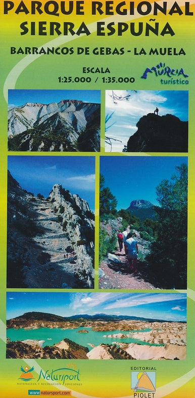
Hiking Map of the Sierra Espuña Regional Park on the Spanish coast.
The Spanish Editorial Pitolet publisher produces particularly detailed maps of the Spanian subregions, adapted to hikers and mountain bikers. Traditionally, they started in the region of Barcelona, but they extend more and more to other parts of Spain.
The maps have a topographic background with curves, peaks, shadows on the ridges of mountains, roads and villages, hamlets and even farms. In addition, they have marked some hiking trails, including the GR trails and the PR trails, the regional trails of great hiking. Other hiking trails are marked, but with normal black lines instead of a striking color. MTB routes are also indicated on some maps, but it is the exception rather than the rule. Symbols indicate other useful things such as campsites, attractions, caves, etc.
ISBN/EAN : 9788415075608
Publication date: 2012
Scale: 1/25,000 (1cm=250m) & 1/35,000
Folded dimensions: 12x21cm
Language(s): Castilian, English
Weight:
80 g