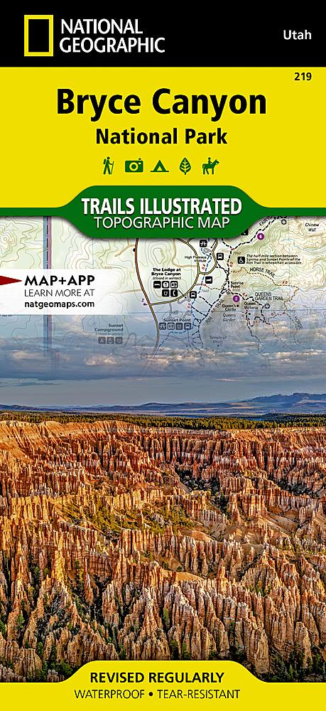
Carte de randonnée - Moab Ouest - Klondike Bluffs, Dead Horse Point (Utah) | National Geographic carte pliée National Geographic

Hiking Map #506 - Moab West Klondike Bluffs, Dead Horse Point (Utah) | National Geographic | National Geographic

Hiking Map #506 - Moab West Klondike Bluffs, Dead Horse Point (Utah) | National Geographic | National Geographic

Regular price $18.00
/
  • Shipping within 24 working hours from our warehouse in France
  • Delivery costs calculated instantly in the basket
  • Free returns (*)
  • Real-time inventory
  • In stock, ready to ship
  • Backordered, shipping soon
Tax included.

Topographic map of the western region of Moab (Utah) with the famous Dead Horse Point in particular. Detailed map ideal for hiking with contour lines spaced 100 feet apart, trekking paths, places of accommodation (campsites), ranger bases.

Waterproof and tear-resistant detailed map.


ISBN/EAN : 9781566959018
Publication date: 2022
Scale: 1/90,000 (1cm=900m)
Printed sides: both sides
Folded dimensions: 23.5 x 10.9cm
Unfolded dimensions: 95x65cm
Language(s): English
Poids : 89 g

Customer Reviews

No reviews yet
0%
(0)
0%
(0)
0%
(0)
0%
(0)
0%
(0)