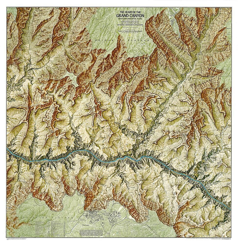
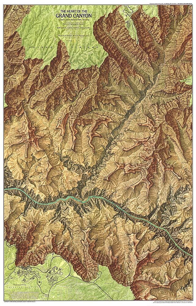
Hiking Map of Bright Angel Canyon, North & South Rims (PN Grand Canyon, Arizona) | National Geographic

Carte de randonnée de Bright Angel Canyon, North & South Rims (PN Grand Canyon, Arizona) | National Geographic carte pliée National Geographic

Hiking Map of Bright Angel Canyon, North & South Rims (PN Grand Canyon, Arizona) | National Geographic

Regular price $18.00
/
  • Shipping within 24 working hours from our warehouse in France
  • Delivery costs calculated instantly in the cart
  • Free returns (*)
  • Real-time inventory
  • In stock, ready to ship
  • Inventory on the way
Tax included.

Often purchased together:

Topographic Map of the Bright Angel Canyon and North & Amp area South Rims in the Grand Canyon National Park (Arizona) in the United States. Detailed map published by National Geographic with curves, trekking paths, accommodation (camping), the bases of Rangers. Waterproof and tear-resistant map.


ISBN/EAN : 9781566954952
Publication date: 2016
Scale: 1/35,000 (1cm=350m)
Printed sides: both sides
Folded dimensions: 23.5 x 10.9cm
Unfolded dimensions: 95x65cm
Language(s): English
Poids : 90 g

Customer Reviews

Based on 1 review
100%
(1)
0%
(0)
0%
(0)
0%
(0)
0%
(0)
t
themntneer
The NatGeo topo map arrived ontime ...

The NatGeo topo map arrived ontime and was exactly what I needed for the next hiking trip. The website was functional & easy to use too!