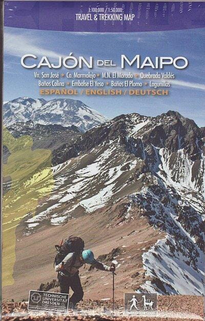
The Cajon del Maipo - Volcán San Jose region of central Chile east of Santiago is featured on a waterproof and tear-resistant map in a series of contoured, GPS-compatible trekking and exploration maps at various scales that make up Trekkingchile. On one side, the main 1:100,000 map covers the region eastward along the Maipo River from Las Vertientes, near its confluence with the Rio Colorado, to Volcán San Jose on the Argentine border. The map shows the region's network of local roads and tracks, indicating both unmarked and marked hiking trails. A wide range of icons indicates various tourist facilities and places of interest, including several types of accommodation, restaurants and cafes, banks, fuel reserves, recreational areas for climbing, canyoning, rafting, and more.
On the reverse, the area west of Volcan San Jose is shown in greater detail at a scale of 1:50,000, with 50m contour lines. Both the main map and the enlargement have a UTM grid, plus margin tick marks for latitude and longitude. The map also includes beautiful color drawings of examples of local wildlife.
The maps in the Trekkingchile series use satellite imagery as a base, with contour lines and colors to indicate different terrain and habitat types. Unless otherwise noted in individual descriptions, the maps have a UTM grid, plus margin tick marks for latitude and longitude. The maps are annotated with tourist information, and most titles include a street map of the main town in the region. Many are illustrated with drawings of local flora or fauna. Map legends and other text are in English.