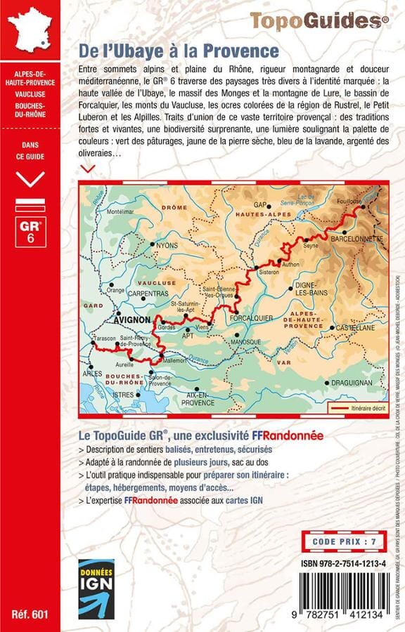
Topoguide de randonnée - De l'Ubaye à la Provence - GR6 | FFR guide de randonnée FFR - Fédération Française de Randonnée

Topoguide Hiking - Crossing the Alps, Maurienne to Ubaye | FFR (French)

Topoguide Hiking - Crossing the Alps, Maurienne to Ubaye | FFR (French)

Regular price $21.00
/
  • Shipping within 24 working hours from our warehouse in France
  • Delivery costs calculated instantly in the basket
  • Free returns (*)
  • Real-time inventory
  • In stock, ready to ship
  • Backordered, shipping soon
Tax included.

Topoguide of the "Great hiking" collection. 9 days of model with larch by the GR ® 5, as much for The turn of the Ubaye.

Since Modane and the Maurienne Valley, the itinerary goes down to Mount Thabor and the watershed between North Alps and Southern Alps. Appear Briançon and its fortifications.

Built on the path of passage between Durance and Po, the city is still impregnated with Italian influence. We then enter the queyras, including the spacious valleys and shale ridges form the paradise of hikers. The trail cuts dry grasslands surrounded by larch forests. Farms have kept their shingle roofs with sun and snow.

On the larche path, comes the ubaye, to the relief tormented by erosion. On sunny slopes, the climate already has Mediterranean nuances, and the protected wildlife of the Mercantour flourished with peace of mind.


ISBN/EAN : 9782751412134
Publication date: 2023
Pagination: 160 pages
Folded dimensions: 21 x 13.5cm
Language(s): French
Poids : 250 g

Customer Reviews

Be the first to write a review
0%
(0)
0%
(0)
0%
(0)
0%
(0)
0%
(0)