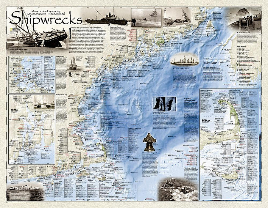
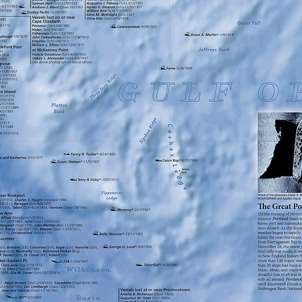
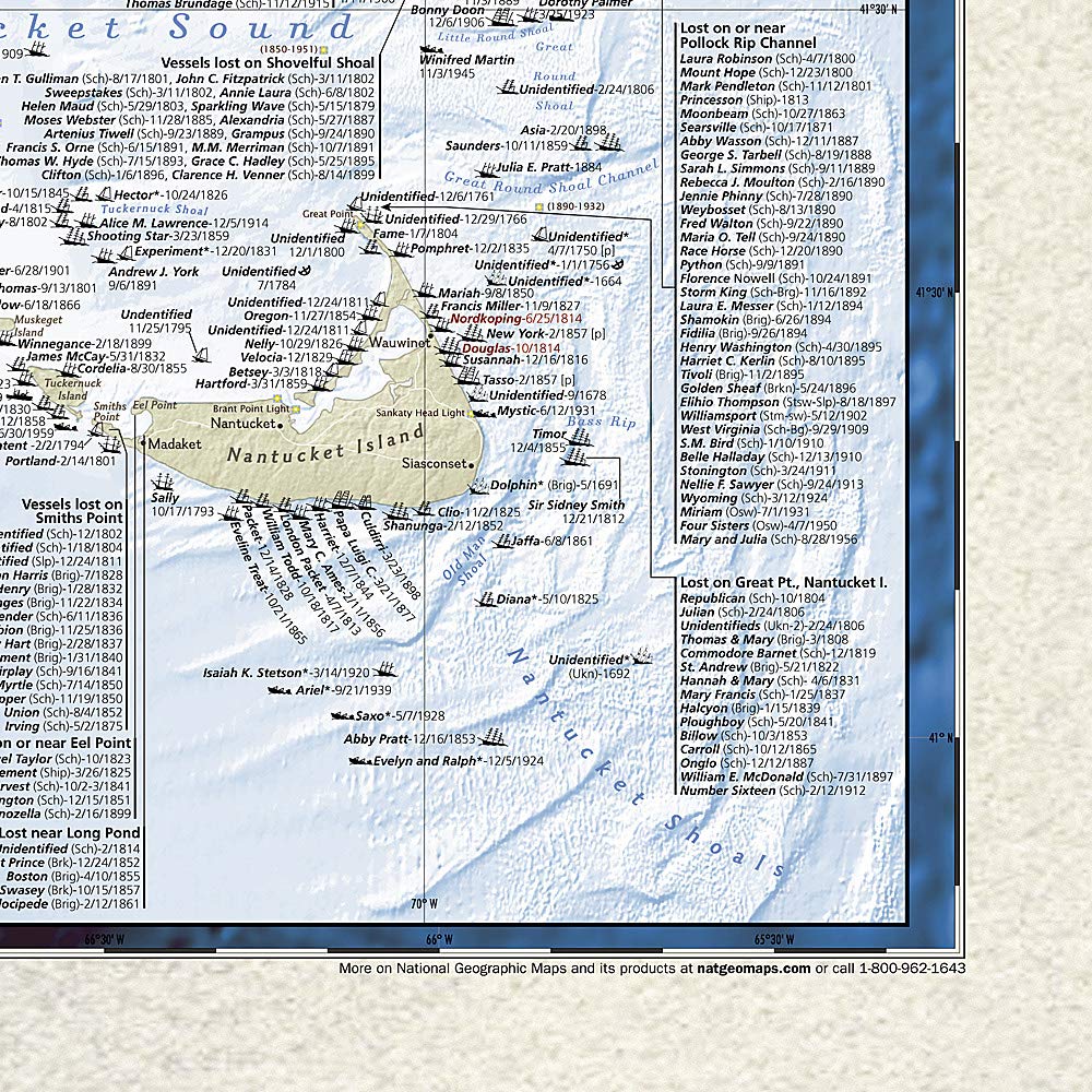
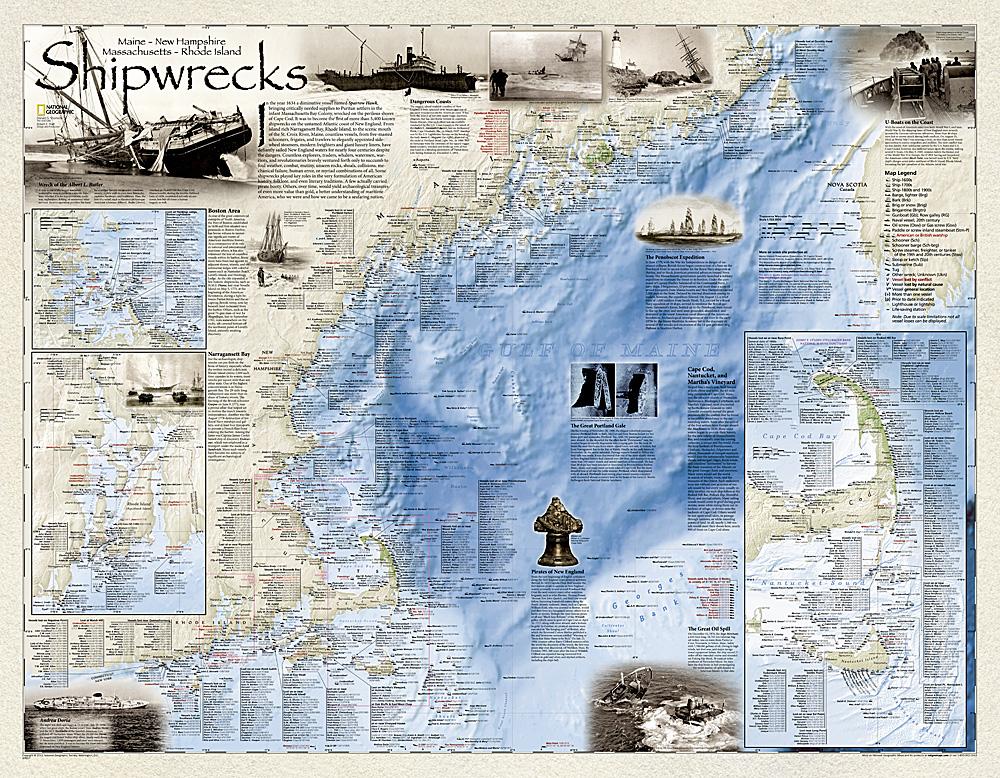
Carte murale (en anglais) - Naufrages de bateaux dans le nord-est américain | National Geographic carte murale petit tube National Geographic Papier
Carte murale (en anglais) - Naufrages de bateaux dans le nord-est américain - 91 x 71 cm | National Geographic carte murale petit tube National Geographic
Carte murale (en anglais) - Naufrages de bateaux dans le nord-est américain | National Geographic carte murale petit tube National Geographic Plastifiée
Carte murale (en anglais) - Naufrages de bateaux dans le nord-est américain - 91 x 71 cm | National Geographic carte murale petit tube National Geographic

Wall-mounted map - Boat shipwrecks in Northeast American - 91 x 71 cm | National Geographic

Wall-mounted map - Boat shipwrecks in Northeast American - 91 x 71 cm | National Geographic

Finishing
Regular price $33.00
/
  • Shipping within 7 to 10 working days from our warehouse in France
  • Delivery costs calculated instantly in the basket
Tax included.

Designed by the famous marine archaeologist and author Don Shomette and designed by the award-winning Robert Pratt cartographer, "Shiprewrecks of the Northeast" is a new breathtaking map illustrating more than 5,400 wrecks known on the Atlantic coast of New England (Maine, Massachusetts, New Hampshire and Rhode Island).
of the bay of Narragansett, in the Rhode Islands, at the St. Croix River, in Maine, the wrecks are clearly identified at the top of the beautiful bathymetric and coastal landscapes . Each wreck site is symbolized to define the class, type and name of the ship, accompanied by the shipwreck date. The icons also indicate whether a ship has been lost due to a conflict or natural causes.
Delivered in a laminated protection tube.
Available in paper version or laminatedized.

Note: For the laminated map, an additional time of a few days may be necessary for laminating.


Date de publication : 2011
Impression: front
Dimensions déplié(e) : 91 x 71cm
Langue : English

Customer Reviews

No reviews yet
0%
(0)
0%
(0)
0%
(0)
0%
(0)
0%
(0)