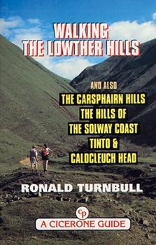
Guide de randonnées (en anglais) - Lowther Hills | Cicerone guide de randonnée Cicerone

Hiking guide (in English) - Lowther Hills | Cicerone

Price
Regular price $14.00
Regular price Sale price $14.00
Save $-14
/
  • Shipping within 24 working hours from our warehouse in France
  • Delivery costs calculated instantly in the basket
  • Free returns (*)
  • Real-time inventory
  • Low stock - 1 item left
  • Backordered, shipping soon
Tax included.

Often purchased together:

Topoguide (in English) of the Cicerone publisher.
Description Provided by the publisher:
Walking in the Lowther Hills and Also The Carsphairn Hills, The Hills of the Solway Coast, Tinto and Cauldcleuch Head. The Lowther Hills Offer High Rounded Ridges WINDSWEPT, Sheep - Nibbled and Solitary. However the Tops are only part of the story. Carefull Discovers Exploration The Small Hidden Valleys, The 'Cleuchs' and 'Linns' That Give This Range Its Particular Character. Here you may MEET A Wild Goat, Gold Find Yourself Involved With a Small Waterfall and a couple of Feet of Rock - Climbing. Along The Solway Coast are Granite Hills, with all the Ruggedness of the Cairngorms But Hardly Any of the Height. Rocky - Topped Criffel, Screel and Cairnsmore of Fleet Contrast Bicely With The Steep - Sided Grassy Hills Inland, and with the Gorse and Beaches of the Solway Coast. THESE 50 walks COVER ALL THE HILLS WEST OF THE M74 EXCEPT THE MERRICK AND RHINNS OF KELLS. In Case of Bad Weather, There are Also A FEW Woodland and Coastal walks.


ISBN/EAN : 9781852842758
Publication date: 1999
Folded dimensions: 12 x 17cm
Language(s): English
Weight: 211 g

Customer Reviews

No reviews yet
0%
(0)
0%
(0)
0%
(0)
0%
(0)
0%
(0)
Carte de randonnée - West Highland Way XT40 | Harvey Maps - National Trail maps carte pliée Harvey Maps
Hiking map - West Highland Way XT40 | Harvey Maps - National Trail Maps
Harvey Maps
$27.00
Carte de randonnée n° 392 - Ben Nevis, Fort William (Grande Bretagne) | Ordnance Survey - Explorer carte pliée Ordnance Survey
Hiking map # 392 - Ben Nevis, Fort William (Great Britain) | Ordnance Survey - Explorer
Ordnance Survey
from $21.00
Carte de randonnée n° 408 - Skye, Trotternish, The Storr (Grande Bretagne) | Ordnance Survey - Explorer carte pliée Ordnance Survey
Hiking map # 408 - Skye, Trottish, The Storr (Great Britain) | Ordnance Survey - Explorer
Ordnance Survey
from $21.00
Carte topographique n° 023 - North Skye (Grande Bretagne) | Ordnance Survey - Landranger carte pliée Ordnance Survey
Topographic map # 023 - North Skye (Great Britain) | Ordnance Survey - Landranger
Ordnance Survey
from $21.00