Hiking Map # 8 - Cerdagne and Capcir (Catalan Pyrenees) | Rando Editions (French)

Carte de randonnée n° 8 - Cerdagne et Capcir (Pyrénées Catalanes) | Rando Editions carte pliée Rando Editions

Hiking Map # 8 - Cerdagne and Capcir (Catalan Pyrenees) | Rando Editions (French)

Regular price $17.00
/
  • Shipping within 24 working hours from our warehouse in France
  • Delivery costs calculated instantly in the cart
  • Free returns (*)
  • Real-time inventory
  • In stock, ready to ship
  • Inventory on the way
Tax included.

Often purchased together:

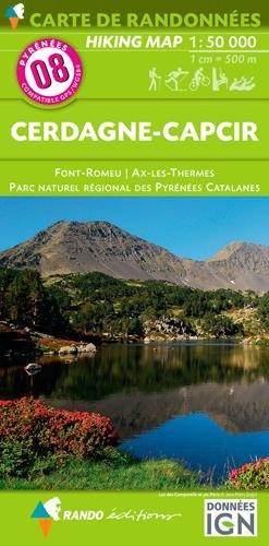
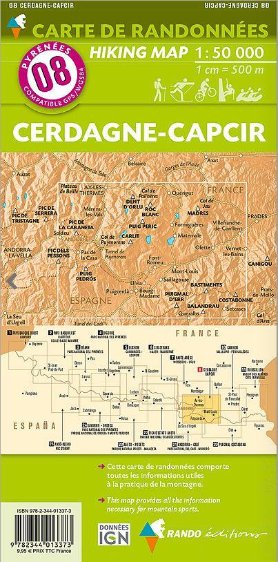
Pyrénées Hiking Map # 8, edited by Rando Editions, which covers the region of Cerdagne and Capcir in the Eastern Pyrenees. This hiking map covers the region of Font-Romeu, Ax-les-Thermes and the Catalan Pyrenees Regional Nature Park. Level curves and tourist information included (accommodation etc ...). Scale 1/50 000 (1 cm = 500 m).


ISBN/EAN : 9782344013373
Publication date: 2016
Scale: 1/50,000 (1cm=500m)
Printed sides: front
Folded dimensions: 22.5 x 11 x 0.5cm
Unfolded dimensions: 131 x 90cm
Language(s): French English
Poids : 90 g

Customer Reviews

Based on 1 review
100%
(1)
0%
(0)
0%
(0)
0%
(0)
0%
(0)
A
Agnès R. (Abrest, FR)

merci pour votre carte qui correspondait parfaitement à ce que j'en attendais.

More from Rando Editions
Carte générale touristique - Pyrénées | Rando Editions carte pliée Rando Editions
General Tourist Map - Pyrenees | Rando Editions (French)
Rando Editions
$13.00
Carte de randonnée n° 1 - Pays Basque Ouest (Labourd, Basse-Navarre) | Rando Editions carte pliée Rando Editions
Hiking Map # 1 - West Basque Country (Labourd, Lower Navarre) | Rando Editions (French)
Rando Editions
$17.00
Carte de randonnée n° 2 - Pays Basque Est (Pyrénées) | Rando Editions carte pliée Rando Editions
Hiking Map # 2 - Basque Country East (Pyrenees) | Rando Editions (French)
Rando Editions
$17.00
Carte de randonnée du Béarn (Pyrénées), n°3 | Rando Editions - La Compagnie des Cartes
Hiking Map # 3 - Béarn (Pyrenees) | Rando Editions (French)
Rando Editions
$17.00
Carte de randonnée n° 4 - Bigorre (Pyrénées) | Rando Editions carte pliée Rando Editions
Hiking Map # 4 - Bigorre (Pyrenees) | Rando Editions (French)
Rando Editions
$17.00
Recently viewed