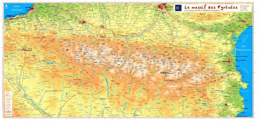
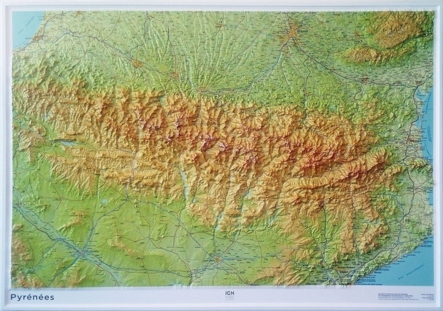
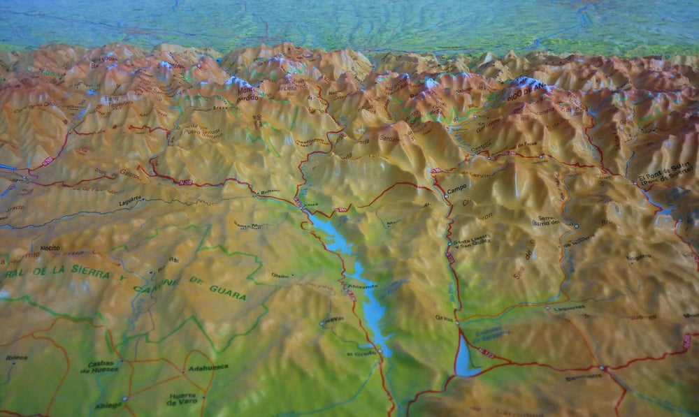
Relief map - The Pyrenees massif and the paths to Santiago de Compostela - 62 X 32 cm
Regular price
$39.00
Regular price
Sale price
$39.00
Save $-39
/
- Product on order - Shipping within 5 to 8 working days from our warehouse in France
- Delivery costs calculated instantly in the basket
Related geographic locations and collections: 3D Raised-Relief Maps, Ariège (department 09), Ariège Pyrenees, Aude (department 11), France GR footpaths, Gers (department 32), GR10 - Pyrenees Mountains, Haute-Garonne (department 31), Hautes-Pyrenees (department 65), Hérault (department 34), Pyrenees, Pyrénées-Atlantiques (department 64), Wall Maps, Way of Saint James (Camino de Santiago)