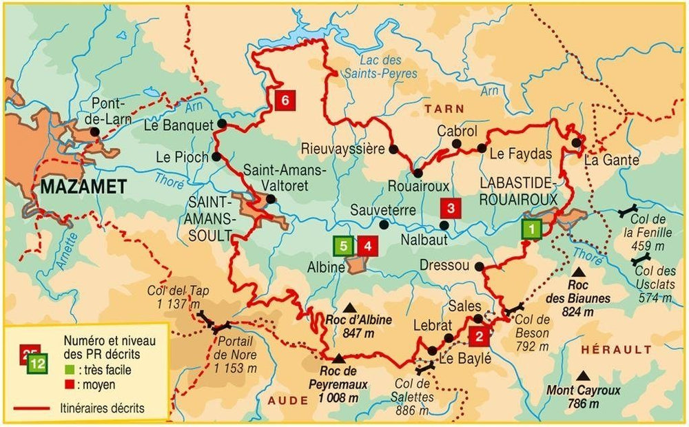
Topoguide de randonnée - La Haute Vallée du Thoré (PNR du Haut-Languedoc, Tarn, Aude, Hérault) | FFR guide de randonnée FFR - Fédération Française de Randonnée

Hiking Topoguide - The High Vallée du Thoré (Haut-Languedoc PNR, Tarn, Aude, Hérault) | FFR (French)

Hiking Topoguide - The High Vallée du Thoré (Haut-Languedoc PNR, Tarn, Aude, Hérault) | FFR (French)

Regular price $16.00
/
  • Shipping within 24 working hours from our warehouse in France
  • Delivery costs calculated instantly in the basket
  • Free returns (*)
  • Real-time inventory
  • In stock, ready to ship
  • Backordered, shipping soon
Tax included.
Topoguide of the "Great Hiking" collection.
82 km of gr de country and 6 walks between valley and middle mountain, in the heart of the Regional Natural Park of Haut-Languedoc.
At the gates of Mazamet, between Castres and Beziers, the high throde valley is a real greenery. Located in the heart of the Regional Natural Park of Haut-Languedoc, Ellle will surprise the hiker through its heritage wealth and magic that the Black Mountain emerges.
In contact with ocean sweetness and Mediterranean heat, paths, sifters and layouts cross forests, streams and rivers. The greenway, passed pais, meanwhile, makes it possible to meet the people with the inhabitants singing southwest.


ISBN/EAN : 9782751407888
Publication date: 2015
Pagination: 72 pages
Folded dimensions: 21x13cm
Language(s): French
Poids : 119 g

Customer Reviews

No reviews yet
0%
(0)
0%
(0)
0%
(0)
0%
(0)
0%
(0)