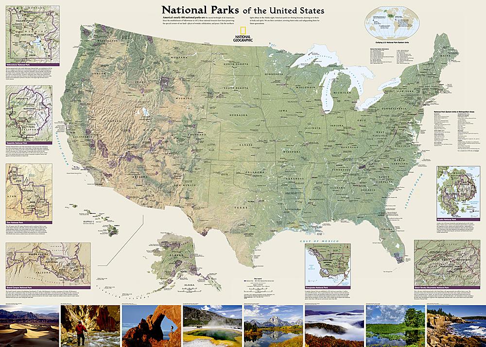
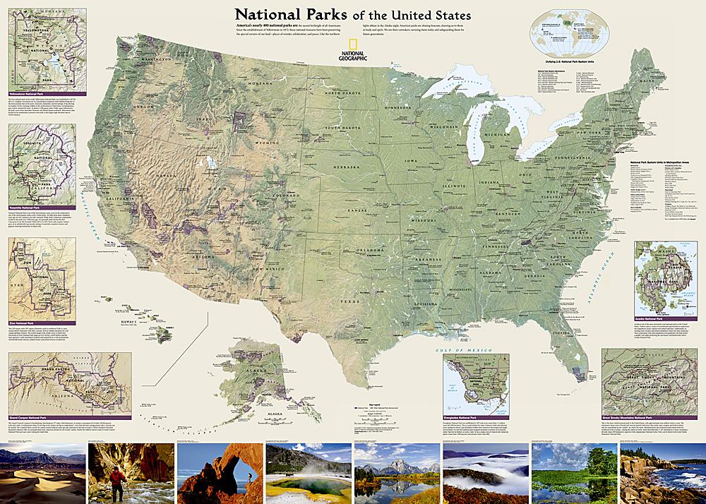
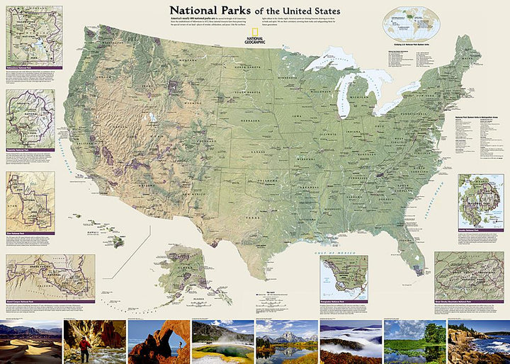
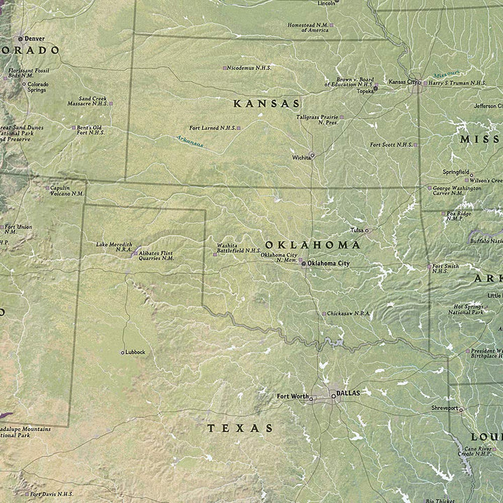
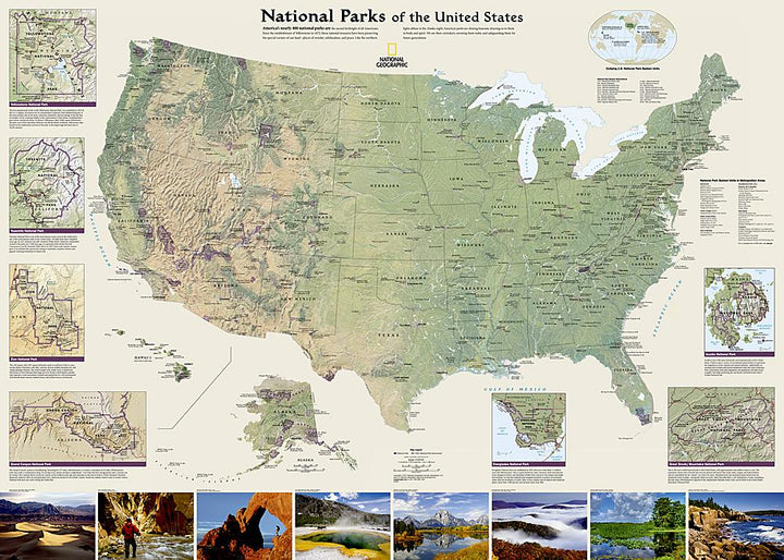
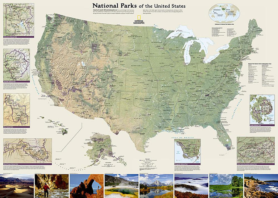
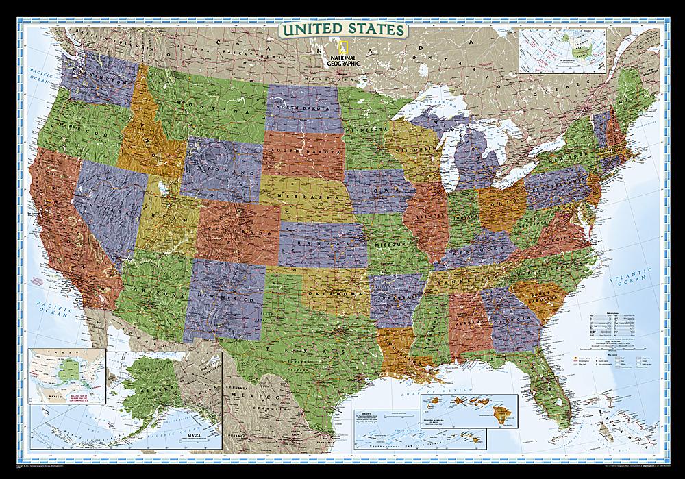
Wall map of the United States National Parks published by the National Geographic.
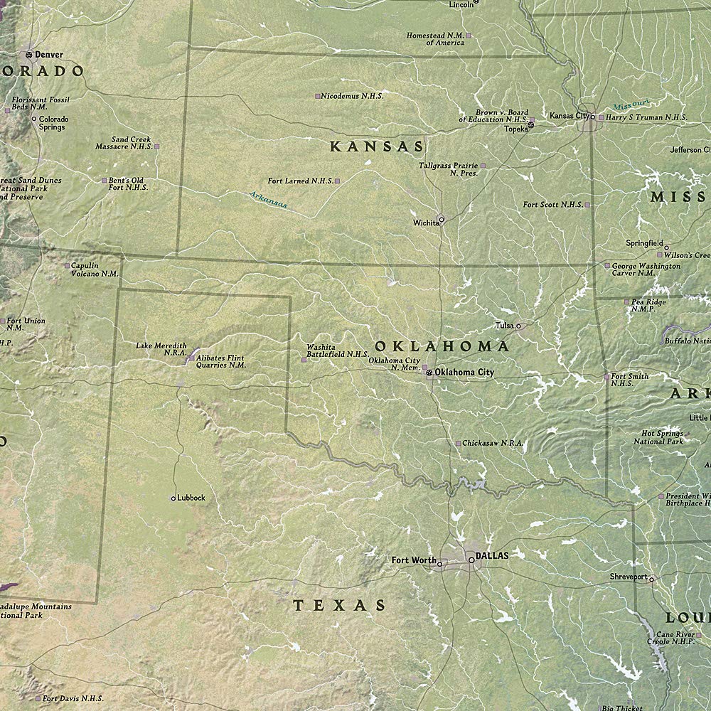
This map highlights nearly 400 magnificent parks across America. The country is represented in subtle tones with shaded mountain relief and elaborate hydrographic networks. The photos capture some of the various preserved landscapes and protected by the system of the national parks.
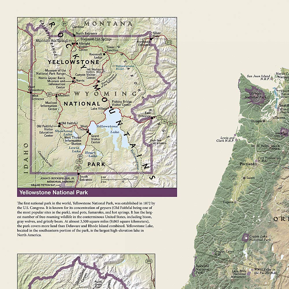
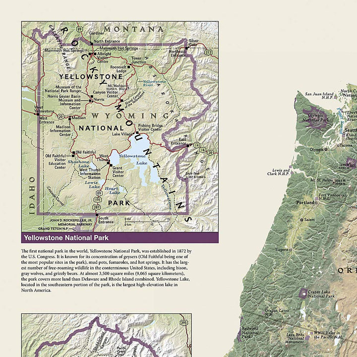
Separate inserts provide details and descriptions of seven parks: Yellowstone, Yosemite, Acadia, Grand Canyon, Great Smoky Mountains, Everglades and Zion .
The most popular places on the map include Yellowstone, Yosemite, Denali, Joshua Tree, Acadie, Grand Canyon, Great Smoky Mountains, Volcanoes from Hawaii, Everglades, Zion, Mount Rushmore, Great Sand Dune and Rocky Mountain.
Delivered in a laminated protection tube.
Available in paper version or laminatedized.
Note: For the laminated map, an additional time of a few days may be necessary for laminating.
Date de publication : 2022
Impression: front
Dimensions déplié(e) : 107 x 77cm
Langue : English


