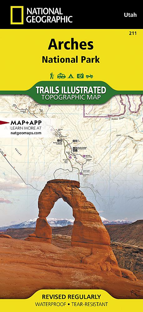
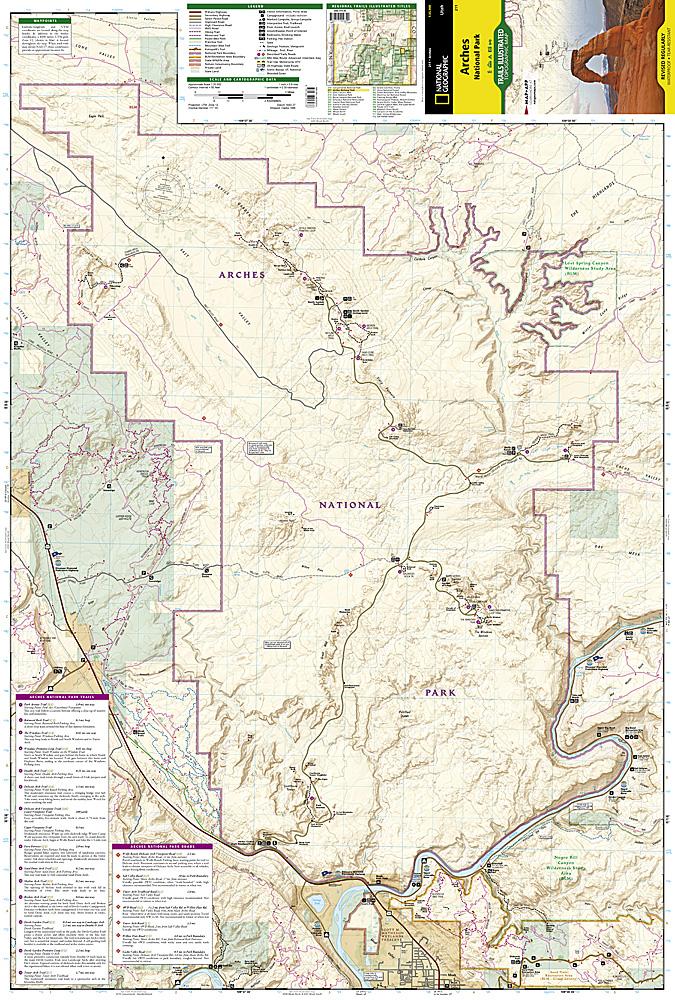
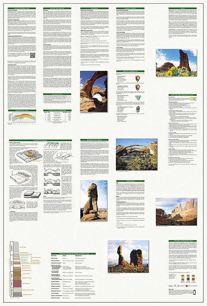
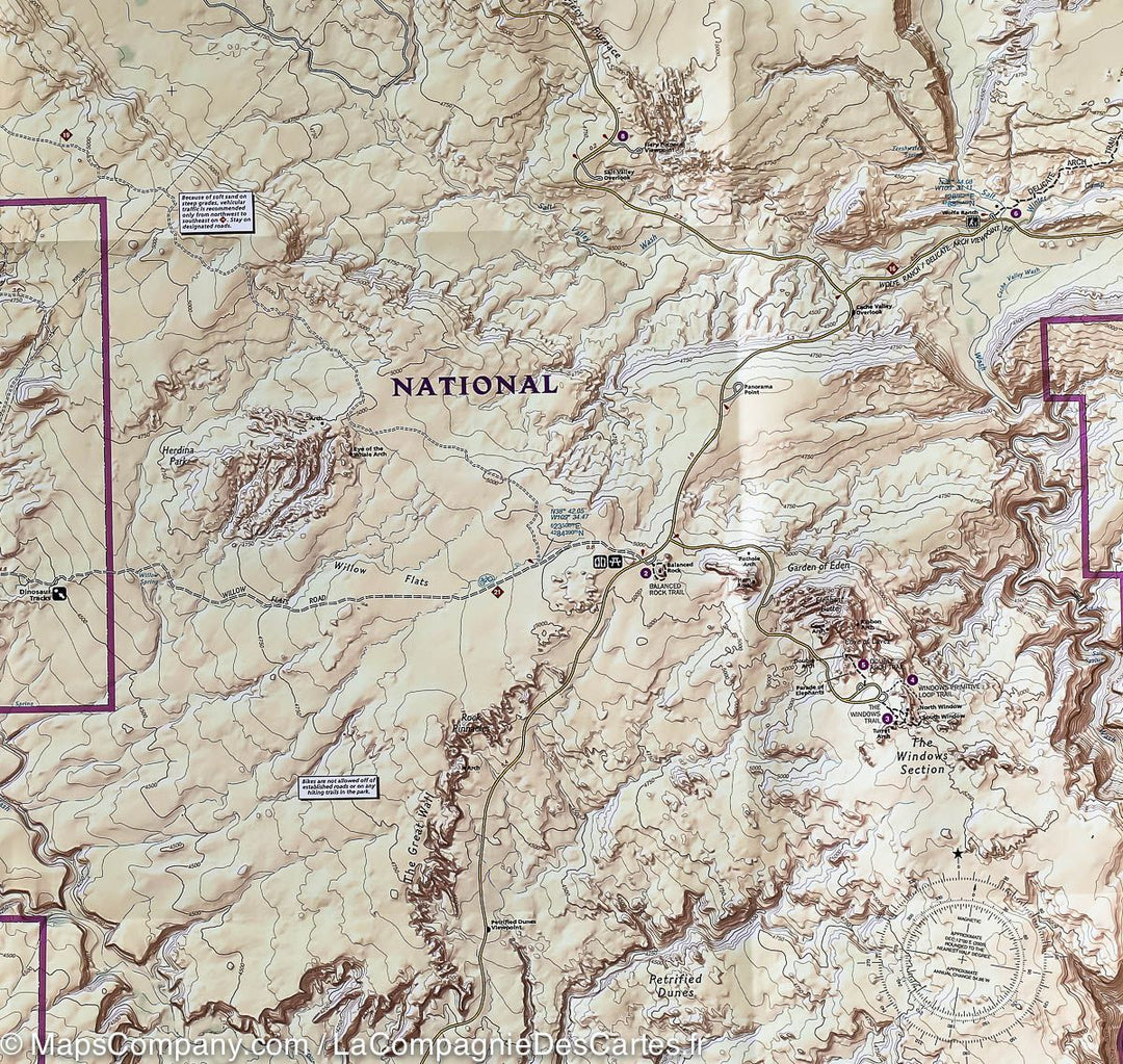
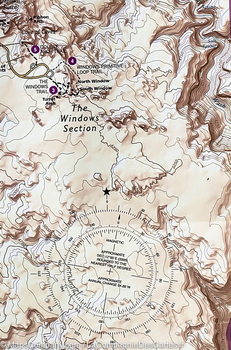
Carte de randonnée du Parc National Arches (Utah) | National Geographic carte pliée National Geographic
Carte de randonnée du Parc National Arches (Utah) | National Geographic - La Compagnie des Cartes
Carte de randonnée du Parc National Arches (Utah) | National Geographic carte pliée National Geographic
Carte de randonnée du Parc National Arches (Utah) | National Geographic - La Compagnie des Cartes

Arches National Park Hiking Map (Utah) | National Geographic

Arches National Park Hiking Map (Utah) | National Geographic

Regular price $18.00
/
  • Shipping within 24 working hours from our warehouse in France
  • Delivery costs calculated instantly in the basket
  • Free returns (*)
  • Real-time inventory
  • In stock, ready to ship
  • Backordered, shipping soon
Tax included.

Topographic Map of the Arches National Park (Utah) in the United States published by National Geographic. Level curves spaced 50 feet, indication of trekking paths, accommodation (campsites), bases of range.

Detailed waterproof and tearing resistant.


ISBN/EAN : 9781566953276
Publication date: 2022
Scale: 1/35,000 (1cm=350m)
Printed sides: both sides
Folded dimensions: 23.5 x 10.9cm
Unfolded dimensions: 95x65cm
Language(s): English
Poids : 89 g

Customer Reviews

Based on 2 reviews
100%
(2)
0%
(0)
0%
(0)
0%
(0)
0%
(0)
N
Nicolas R. (Villepreux, FR)
Carte pour randonneurs

Carte topographique plastifiée, idéale pour la randonnée

M
Mario B. (Seingbouse, FR)

Très bons produits conforme à mes attentes.