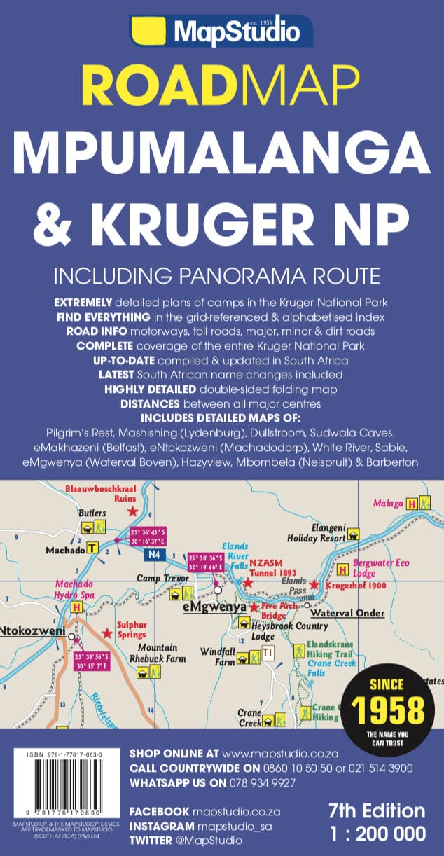
Detailed Road map of Mpumalanga Province (South Africa) published by MapStudio. This detailed map covers the panoramic road and Kruger National Park. On the back, detailed map of Kruger National Park with tourist indications (accommodation, activities etc ...).
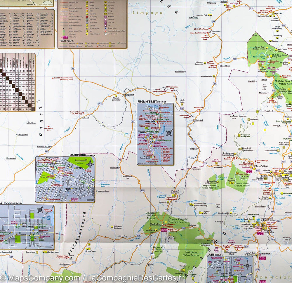
Detailed streetmaps and site maps with text and photography of Pilgrims Rest, Mashishing (Lydenburg), Dullstroom, Sudwala Caves, eMakhazeni (Belfast), eNtokozweni (Machadodorp), White River, Sabie, eMgwenya (Waterval Boven), Hazyview, Mbombela (Nelspruit) and Barberton
Easy-to-use map symbols showing hotel, lodges, rest camps, campsites, concession areas, bush camps, private rest camps and lodges, caravan facilities, caves, lookout points, waterholes, hides and much more. Information on hiking, trekking, walking and fly-fishing areas. Along with an alphabetised index, enlarged map of the Sudwala Caves and full-colour images, this road map is a great holiday reference.
Key selling points
• Ideal Mpumalanga, Kruger National
Park & Panorama Route touring map
• 11 detailed town plans
• Detailed Kruger National Park map
• Key tourist information
Scale 1/200 000 (1 cm = 2 km).