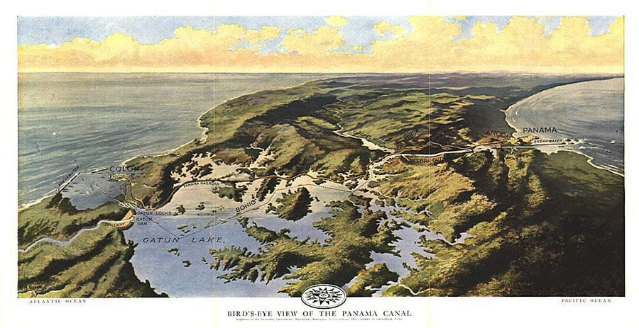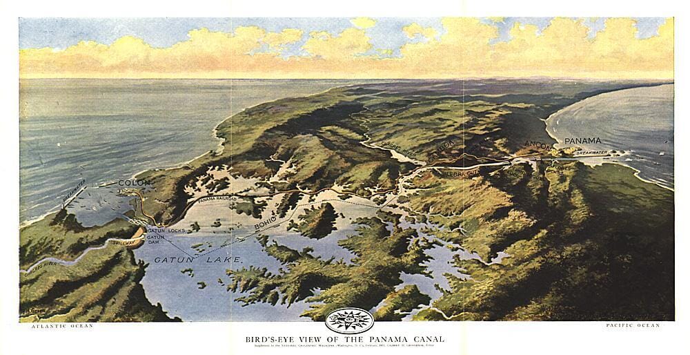
1912 Birds Eye View of the Panama Canal Map Wall Map

1912 Birds Eye View of the Panama Canal Map

Price
Regular price $20.00
Regular price Sale price $20.00
Save $-20
/
  • Shipping within 48 business hours from our warehouse in the USA. For this product, customs fees may be requested by the carrier upon delivery.
  • Delivery costs calculated instantly in the basket
  • Free returns (*)
  • Real-time inventory
  • In stock, ready to ship
  • Backordered, shipping soon
Tax included.

Often purchased together:

Published in February 1912 two years before the Panama Canal opened, this stunning relief map - painting illustrates the Panama railroad, locks, breakwater, and other details of the region. One of the largest engineering projects ever undertaken, the canal had an enormous impact on shipping, creating a passage between the Pacific and Atlantic Oceans. Prior to the canal's opening, ships had to travel the long and treacherous route around the tip of South America.


ISBN/EAN : 2321534M
Publication date: 1912
Unfolded dimensions: 18.75in / 9.5in
Language(s): English
Weight: 200 g

Customer Reviews

Be the first to write a review
0%
(0)
0%
(0)
0%
(0)
0%
(0)
0%
(0)
More from Panama
Carte routière - Panama | National Geographic carte pliée National Geographic
Road map - Panama | National Geographic
National Geographic
$18.00
Carte routière - Costa Rica & Panama | Reise Know How carte pliée Reise Know-How
Road map - Costa Rica and Panama | Reise Know How
Reise Know-How
$13.00
Carte de voyage - Amérique du Sud, partie sud | ITM carte pliée ITM
Travel map - South America, South Part | ITM
ITM
$14.00
Guide de conversation - Espagnol | Lonely Planet guide pratique Lonely Planet
Conversation Guide - Spanish | Lonely Planet (French)
Lonely Planet
$9.00