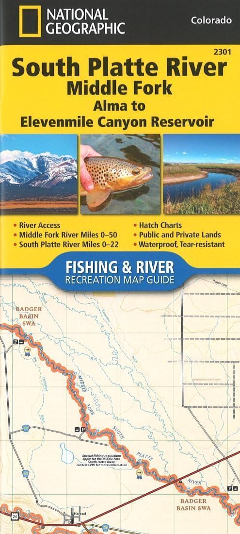
The South Platte River (Middle Fork), Alma to Elevenmile Canyon Reservoir Fishing & River Map Guide" is designed to be the perfect companion for anyone recreationally involved in the upper Middle Fork of the South Platte. In the upper reaches of the South Platte basin, the Middle Fork and South Fork (above Antero) are classic freestone streams (with beaver ponds) that are consistently erratic in flow, water temperature, clarity, hatches, and many other variables such as freezing during the winter months. In comparison, the tailwater streams (i.e., below Antero and Spinney Mountain Reservoir) are much more predictable, providing anglers with consistent fishing year-round. This Fishing & River Map Guide includes the area between Spinney Mountain and Elevenmile Reservoirs, known as "Dream Stream," which is renowned for producing some of the largest trout in the country.
Each Fishing & River Map Guide includes detailed river maps at a scale of 1 inch = 1/2 mile. At this scale, every river bend and rapid is clearly depicted and labeled. Each page is centered on the river and overlaps with adjacent pages, making it easy to find any spot along the river. The maps include river miles, access points, private and public lands, gauging stations, recreation sites, and more.
Pat Dorsey, one of Colorado's most respected fly fishing guides and authors, wrote the introduction, along with descriptions of specific fly fishing strategies and seasonal river fluctuations. You'll also find stream flow charts, hatch charts, and a table of river access points.
More practical and easier to use than folded maps, but just as Compact and lightweight, National Geographic Fishing & River Map Guide booklets are printed on waterproof, tear-resistant Backcountry Tough paper with stainless steel staples. A full UTM grid is printed on the map for easy GPS navigation.