Travel Map - Mississippi Basin & New Orleans Plan | ITM

Price
Regular price $13.00
Regular price Sale price $13.00
Save $-13
/
  • Shipping within 24 working hours from our warehouse in France
  • Delivery costs calculated instantly in the basket
  • Free returns (*)
  • Real-time inventory
  • In stock, ready to ship
  • Backordered, shipping soon
Tax included.

Often purchased together:

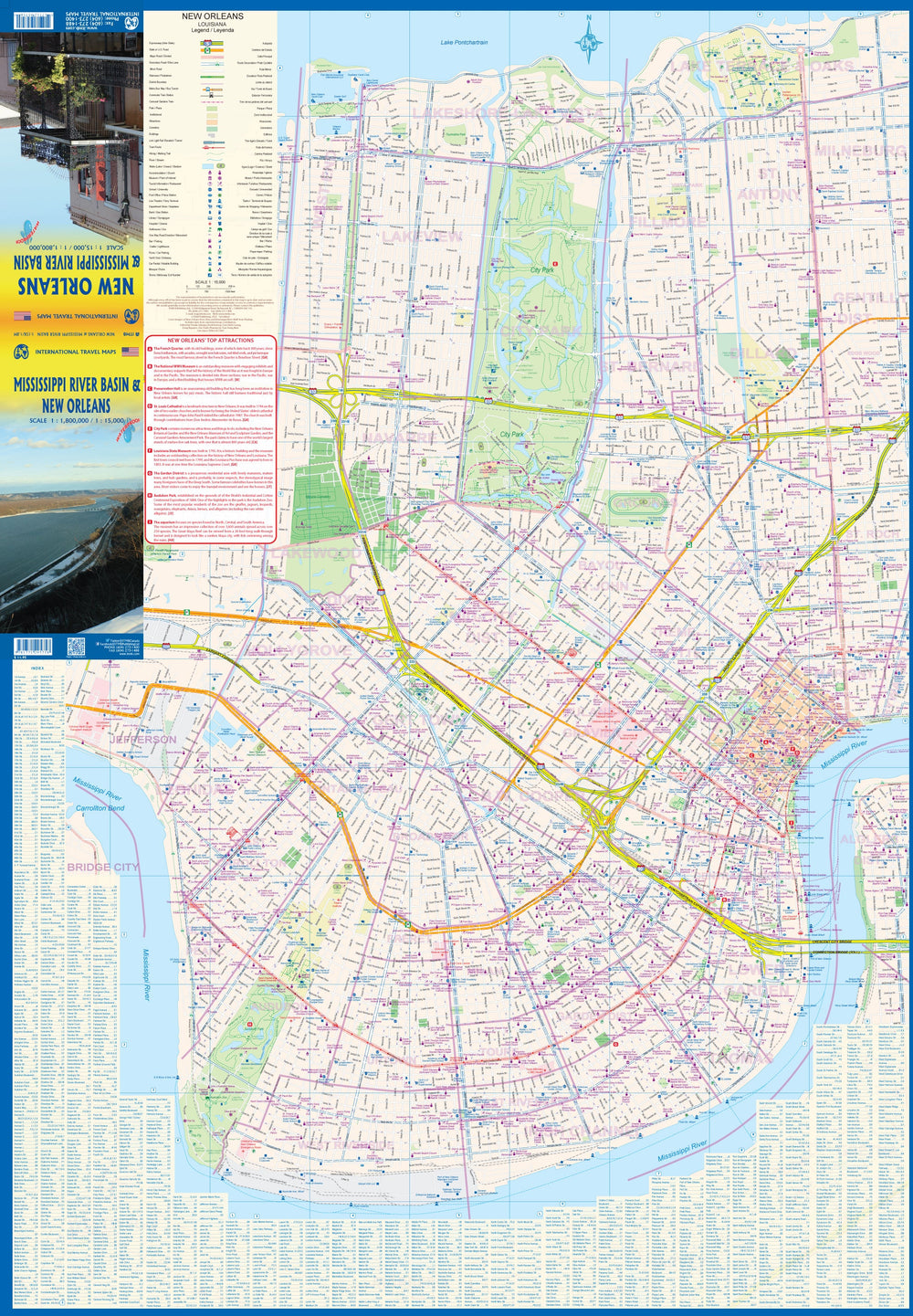
The front of the map shows a detailed plan of New Orleans with a street index.

The back of the map shows the entire Mississippi basin and therefore covers the Midwest and the Great Plains. The map extends north to Milwaukee, Minnesota and west to Omaha and Nebraska. But it's essentially a map centered on the great Mississippi River as it travels south through Dubuque to St. Louis, down to Memphis, Vicksburg, and Natchez, ending in the Gulf of Mexico.

This card is waterproof and tear resistant.


ISBN/EAN : 9781771295758
Publication date: 2022
Scale: 1/1,800,000 (1cm=18km) & 1/15,000 (1cm=150m)
Printed sides: both sides
Folded dimensions: 24.6 x 10.3 x 0.5cm
Unfolded dimensions: 100 x 69cm
Language(s): English
Weight: 80 g

Customer Reviews

No reviews yet
0%
(0)
0%
(0)
0%
(0)
0%
(0)
0%
(0)
More from Louisiana
New !
Carte de voyage - Mississippi River (USA) | ITM carte pliée ITM
Travel Map - Mississippi River (USA) | ITM
ITM
$13.00
Guide de voyage de poche (en anglais) - Nouvelle-Orléans | Lonely Planet guide petit format Lonely Planet EN
Pocket Travel Guide - Hamburg | Lonely Planet
Lonely Planet EN
$13.00
Louisiana, Easy to Fold State Map | Rand McNally carte pliée
Louisiane, carte d'état facile à plier | Rand McNally carte pliée Rand McNally
Louisiana, Easy to Fold State Map | Rand McNally
Rand McNally
$13.00
Scenic road trips of Louisiana & Mississippi | MAD Maps carte pliée
Scenic road trips of Louisiana & Mississippi | MAD Maps
MAD Maps
$20.00
1930 Louisiana Map Wall Map
1930 Louisiana Map
National Geographic Historic POD
$20.00