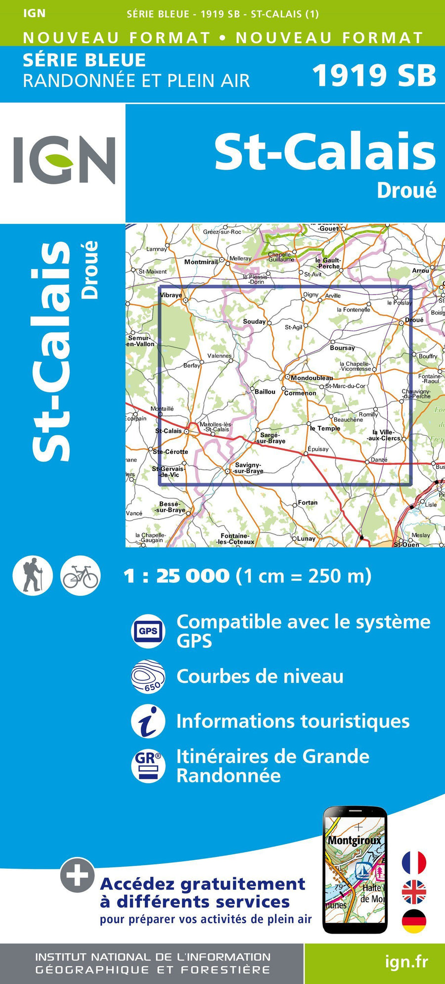
Hiking Map # 1919 - St-Calais, Droué | IGN - Blue Series

Carte de randonnée n° 1919 - St-Calais, Droué | IGN - Série Bleue carte pliée IGN

Hiking Map # 1919 - St-Calais, Droué | IGN - Blue Series

Regular price $16.00
/
  • Shipping within 24 working hours from our warehouse in France
  • Delivery costs calculated instantly in the cart
  • Free returns (*)
  • Real-time inventory
  • In stock, ready to ship
  • Inventory on the way
Tax included.

Often purchased together:

The indispensable hiking map! These topographic maps of a very high accuracy contain all existing details in the field: communication pathways to the slightest path, constructions to the hangar, wood, isolated tree, river, source ... without forgetting the representation of the relief by level curves.


ISBN/EAN : 9782758534020
Publication date: 2015
Scale: 1/25,000 (1cm=250m)
Folded dimensions: 22 x 11cm
Unfolded dimensions: 96cm x 132cm
Language(s): French, English, German
Poids : 89 g

Customer Reviews

No reviews yet
0%
(0)
0%
(0)
0%
(0)
0%
(0)
0%
(0)
Carte départementale D41-45 - Loir-et-Cher & Loiret | IGN carte pliée IGN
Departmental Map D41-45 - Loir-et-Cher & Loiret | IGN
IGN
$7.00
Carte TOP 100 n° 127 - Orléans, Blois, Sologne & Val de Loire | IGN carte pliée IGN
Top 100 Map ° 127 - Orléans, Blois, Sologne & Val de Loire | IGN
IGN
$10.00
Carte TOP 100 n° 133 - Tours, Blois & Vallée et Châteaux de la Loire | IGN carte pliée IGN
Top 100 Map ° 133 - Tours, Blois & valley and castles of the Loire | IGN
IGN
$10.00
Carte départementale n° 318 - Loiret & Loir-et-Cher | Michelin carte pliée Michelin
Departmental Map # 318 - Loiret & Loir-et-Cher | Michelin (French)
Michelin
$8.00
Recently viewed