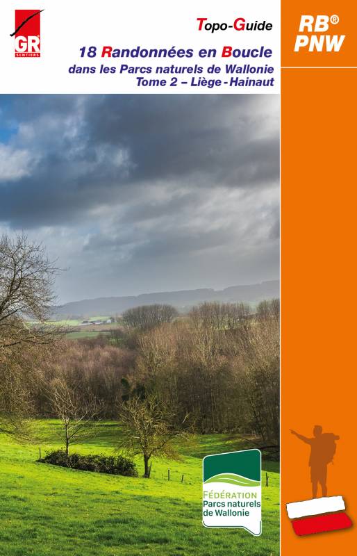
Topoguide de randonnée - Parcs Naturels de Wallonie (Belgique), Tome 2 - Liège - Hainaut | Les Sentiers de Grande Randonnée guide de randonnée Les Sentiers de Grande Randonnée

Hiking guide - Natural Parks of Wallonia (Belgium), Volume 2 - Liège - Hainaut | The Great Hiking Trails

Price
Regular price $28.00
Regular price Sale price $28.00
Save $-28
/
  • Shipping within 24 working hours from our warehouse in France
  • Delivery costs calculated instantly in the basket
  • Free returns (*)
  • Real-time inventory
  • In stock, ready to ship
  • Backordered, shipping soon
Tax included.

Often purchased together:

The “Randonnée en Boucle®” (RB®) topo - guides offer a formula adapted to enthusiasts fond of day trips of around twenty kilometers, supplemented by variants allowing everyone to adapt their route. These walks are based on the GR® or GR®P trails well known to long - distance hikers. Each province offers a topo - guide with 16 RBs, some of them doubling the range of hiking discoveries.
The twelve Natural Parks of Wallonia invite you for a stroll... Available in two volumes, 36 RB® will allow you to discover these rural territories and their multiple facets, to admire without limit the landscapes available to you, this preserved nature, breathtaking panoramas, typical villages and hamlets, the riches of the land, their heritage, ...
The first volume brings together the 18 RBs which travel the country or forest paths within the Natural Parks of the provinces of Namur and Luxembourg, and the second volume the 18 RBs which travel the Natural Parks of the provinces of Liège and Hainaut.

THE HIKES OF VOLUME 2  - LIEGE - HAINAUT
7. HAUTES FAGNES NATURAL PARK - EIFEL 
7A Around the Walloon Fagne: Bosfagne Bridge 21.2 km (13.9 to 23.7 km)
7B In the foothills of the Eifel: Schoenberg 20.6 km (8.7 to 21.3 km)
7C Between the Warche and the forests of Weywertzer and Nidrumer Heck: Nidrum 19.4 km (14.8 km)

8. SOURCE S NATURAL PARK
8A Fagne de Malchamps and Spadoise springs: Berinzenne 12.3 miles (19.6 km)
8B La Gleize, Amblève valley and stag roar: La Gleize 20.4 km (16.2 to 20.9 km)
8C Multi - faceted hike: Moulin du Ruy 22.8 km (13.4 km)

9. BURDINALE - MEHAIGNE NATURAL PARK
9A The agricultural countryside as far as the eye can see: Burdinne 12.2 miles (12.9 km)
9B On the side roads, from chapels to posts: Latin 20.3 km (14.1 km)
9C Quarries and castles: Moha 21.6 km (19.4 km)

10. HIGHLANDS NATURAL PARK
10A On a plateau dug by the Grande Honnelle: Angre 20.1 km (17.3 km)
10B Landscape variations: Sars - la - Bruyère 20.3 km (16.5 or 13.5 km)
10C Hauts - Pays, nature, streams and chapel: Blaugies 19.4 km (14.6 km)

11. PLAINES DE L’ESCAUT NATURAL PARK
11A Rando au Grand Large: Peronnes 17.1 km (15.9 km)
11B Scheldt - Scarpe cross - border hike: Bléharies 19.8km (18.4km)
11C Discovery of a forested Hainaut: Good help 20.7 km (18.2 km)
 
12. HILLLAND NATURAL PARK
2A By the Tops and Bottoms of the Hills: St. Saviour 19.3 km (14.9 or 15.9 km)
12B Sunken paths in clay - sandy soil: Flobecq 20 km (14.1 or 19.2 km)
12C Scenic wandering: Frasnes - lez - Buissenal 10.1 miles (13.4 km)


ISBN/EAN : 9782931078211
Publication date: 2022
Pagination: 160 pages
Folded dimensions: 14 x 21cm
Language(s): French
Weight: 280 g

Customer Reviews

No reviews yet
0%
(0)
0%
(0)
0%
(0)
0%
(0)
0%
(0)