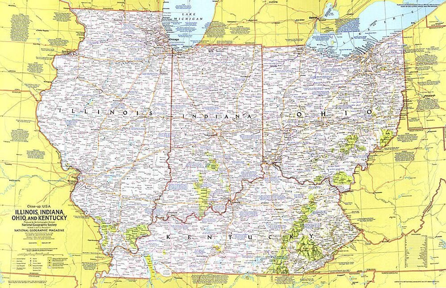
1977 Close-up USA, Illinois, Indiana, Ohio, Kentucky Wall Map

1977 Close - up USA, Illinois, Indiana, Ohio, Kentucky

Price
Regular price $39.00
Regular price Sale price $39.00
Save $-39
/
  • Shipping within 48 business hours from our warehouse in the USA. For this product, customs fees may be requested by the carrier upon delivery.
  • Delivery costs calculated instantly in the basket
  • Free returns (*)
  • Real-time inventory
  • In stock, ready to ship
  • Backordered, shipping soon
Tax included.

Often purchased together:

This regional map of the United States highlights the states of Illinois, Indiana, Ohio, and Kentucky. From the shores of the Great Lakes to the rolling hills of Kentucky, this region boasts unique historic attractions, including the birthplaces of Abraham Lincoln and aviation pioneers Wilbur and Orville Wright, John Glenn, and Neil Armstrong. Published in February 1977 as part of the "Close - up: U.S.A." series, with the travel poster "Tennessee, North Carolina, South Carolina, Georgia, Alabama, and Mississippi."


ISBN/EAN : 2321696M
Publication date: 1977
Unfolded dimensions: 35in / 22.5in
Language(s): English
Weight: 200 g

Customer Reviews

Be the first to write a review
0%
(0)
0%
(0)
0%
(0)
0%
(0)
0%
(0)
More from Indiana
Carte routière n° 584 - sud-est des USA | Michelin carte pliée Michelin
Road map # 584 - USA South - East | Michelin
Michelin
$12.00
Carte routière USA n° 3 - Midwest | Reise Know How carte pliée Reise Know-How 2019
Carte routière USA n° 3 - Midwest | Reise Know How carte pliée Reise Know-How
US Road map # 3 - MIDWEST | Reise Know How
Reise Know-How
$13.00
Indiana : Kittanning : plan de ville | GM Johnson carte pliée GM Johnson
Indiana : Kittanning : city street map | GM Johnson
GM Johnson
$7.00