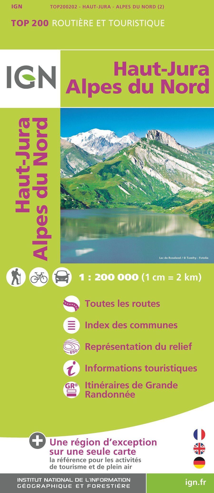
TOP 25 topographic map No. 3325OT of Arbois, Salins-les-Bains, and the Joux State Forest published by IGN.
This hiking map offers contour lines spaced 10 meters apart and a detailed legend (vegetation, rocks, communication routes down to the smallest path, buildings up to the shed, woods, isolated trees, rivers, springs, etc.).
Marked trails and tourist information are indicated. Scale 1:25,000 (1 cm = 250 m).
Municipalities covered : Arbois, Salins les Bains, Joux State Forest, Aresches, Arc-sous-Montenot, Vers-en-Montagne, Supt, Mièges, Villers-sous-Chalamont, Geraise, Le Latet, Plénise, Villeneuve-d'Amont, Les Planches-près-Arbois, Aiglepierre, Dournon, Censeau, Clucy, Molain, Le Pasquier, Bracon, Rix, Pont-d'Héry, Chilly
Places to discover : Levier State Forest, ka Joux State Forest, Fresse State Forest, Fer à Cheval Cirque, Cluse d'Entreportes, Planches Reculée, Crans Castle, Bonmont Abbey, Carroz Cabin, Borsattaz Fir Trees, Saut du Day, Réclère Cave, Les Pralets Cabin, Rochefort Cabin, Roche d'Or Signal, Trois Chalets Cabin, Dent de Vaution Chalet, Orbe Resurgence
ISBN/EAN : 9782758557067
Publication date: 2025
Scale: 1/25,000 (1cm=250m)
Printed sides: front
Folded dimensions: 24 x 11cm
Unfolded dimensions: 96 x 121cm
Language(s): French, English, German
Weight:
89 g