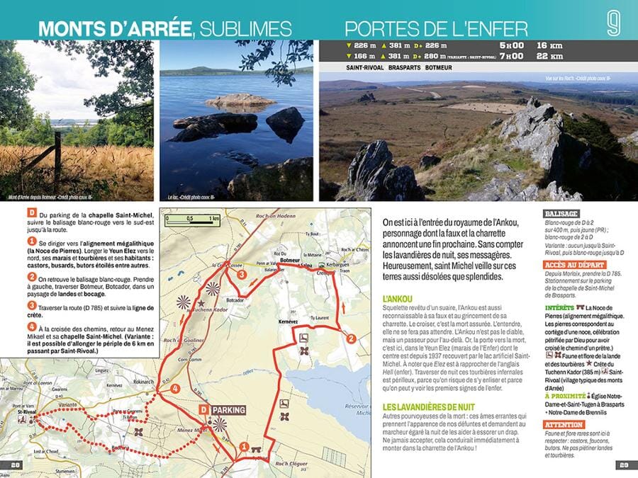
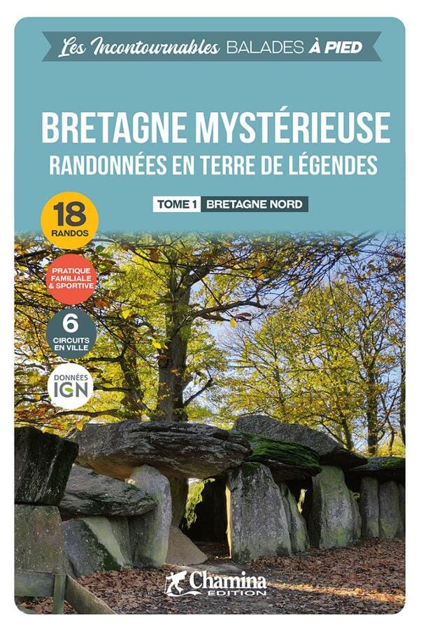
Price
Regular price $13.00
Regular price Sale price $13.00
Save $-13
/
  • Shipping within 24 working hours from our warehouse in France
  • Frais de livraison calculés instantanément dans le panier
  • Retours gratuits (*)
  • Stocks en temps réel
  • Low stock - 1 item left
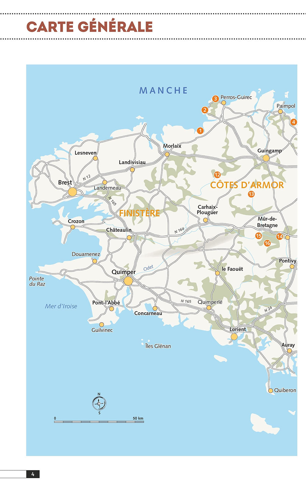
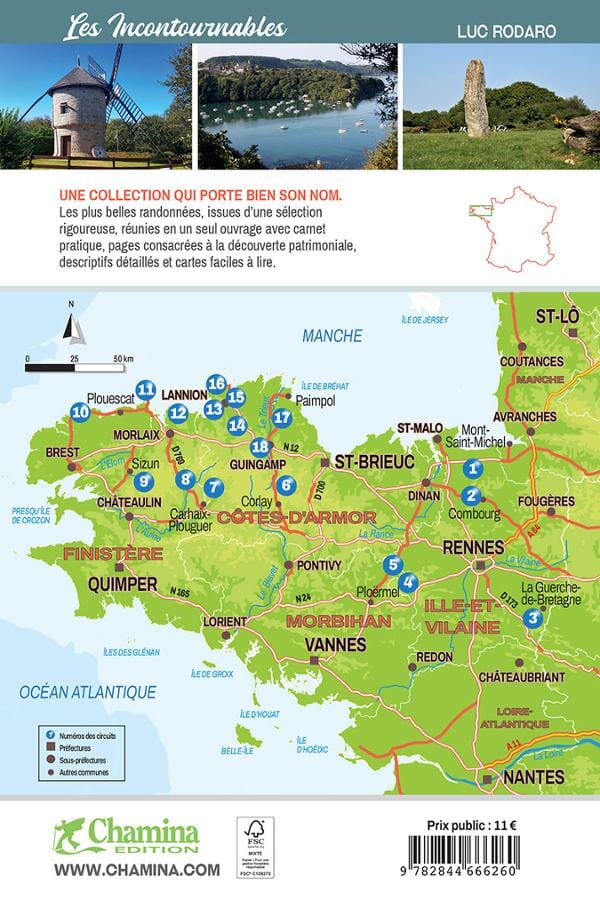
  • Backordered, shipping soon
Tax included.

Souvent achetés ensemble :

Thanks to 20 unmissable walks, Jean-Christophe Mathias invites us to discover the Ile de Ré from every angle. The territory concerned extends from the tip of Chauveau in the south, to the tip of Lizay in the north, and also passes through the many municipalities of the island: La Flotte, Saint-Martin-de-Ré, Le Bois- Plage-en-Ré, La Couarde-sur-Mer, Les Portes-en-Ré, etc. 4 circuits in town allow you to explore them.
Far from being limited to its dunes, the island offers a rich historical heritage, with its fortifications by Vauban and its vestiges of the Second World War. The routes will therefore take you to the famous salt marshes, passing through beautiful forests, until you cross the Atlantic by the famous bridge connecting the island to the mainland.

Strong points :
• 20 itineraries between 1h15 to 5h30 for family and sports practice.
• Cartography on IGN background at 1:25,000 for easy identification.
• Details of points of interest.
• Practical information and useful addresses.


ISBN/EAN : 9782844666260
Publication date: 2023
Pagination: 48 pages
Folded dimensions: 21x14cm
Language(s): French
Poids : 100 g

Customer Reviews

Be the first to write a review
0%
(0)
0%
(0)
0%
(0)
0%
(0)
0%
(0)
CampingCard ACSI - Carte de réductions & Guide - Europe 2024 guide pratique ACSI
CampingCard ACSI - Carte de réductions & Guide - Europe 2022 guide pratique ACSI
CampingMap ACSI - Discounts Map & Guide - Europe (French)
ACSI
$25.00
Guide - Randonner aux îles Lofoten guide de randonnée Topo Guide Lofoten
Guide - Hiking to the Lofoten Islands
Topo Guide Lofoten
$34.00
Guide de randonnée - Madère | Rother guide de randonnée Rother
Guide de randonnée - Madère | Rother guide de conversation Rother
Hiking guide - Madeira | Rother (French)
Rother
$21.00
Guide de randonnée - Ténérife | Rother guide de randonnée Rother
Hiking guide - Tenerife | Rother (French)
Rother
$21.00
CampingCard ACSI - Carte de réductions & Aires camping-cars Europe 2024 guide pratique ACSI
CampingCard ACSI - Carte de réductions & Aires camping-cars Europe 2022 guide pratique ACSI
CampingMap ACSI - Map of Discounts & Aires Campsite Europe (French)
ACSI
$35.00