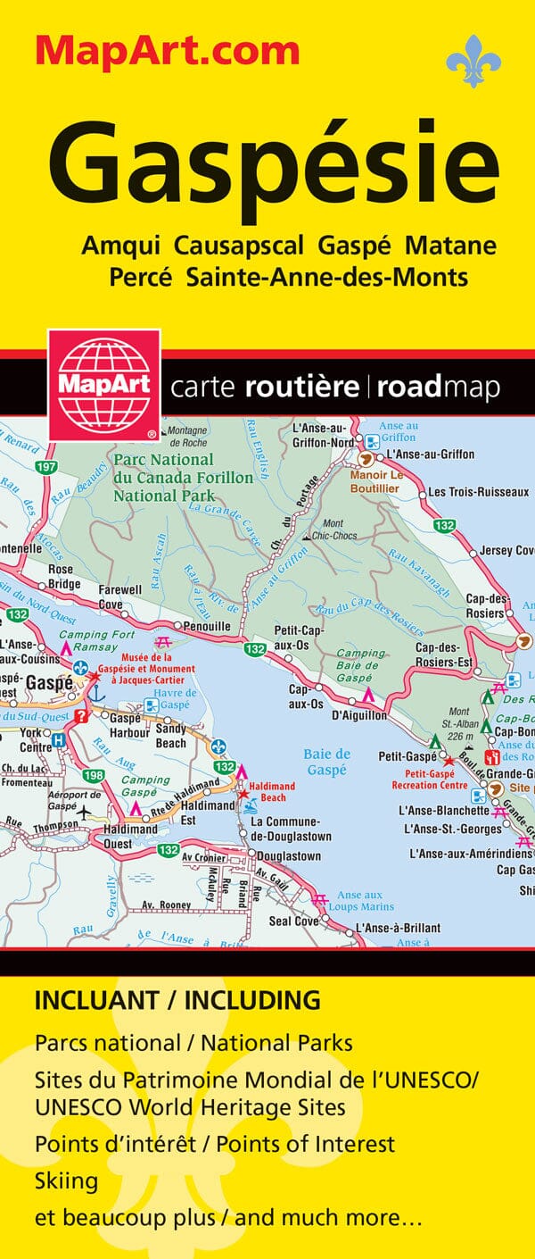
This folded map of the Gaspésie is a comprehensive tool, designed for both road navigation and urban exploration. It combines several levels of interpretation to guide you both in cities and at the regional level.
The map includes detailed city maps at 1:25,000 for:
Amqui, Causapscal, Gaspé, Matane, Percé, Sainte-Anne-des-Monts, with a street index for each location and a key specific to the urban maps.
A regional map at 1:250,000 covers the entire Gaspé Peninsula with An index of towns and roads, as well as a map of the province of Quebec at a scale of 1:10,000,000, for an overview.
The city maps include a wealth of information: main and secondary roads, local streets, one-way streets, private roads, railways, VIA Rail stations, ferries, recreational trails, parks, golf courses, commercial, industrial, and institutional zones, cemeteries, tourist attractions, hospitals, police and fire stations, libraries, swimming pools, community and sports centers, schools, arenas, soccer fields, baseball fields, tennis courts, ski slopes, and campgrounds.
An essential tool for exploring the Gaspé Peninsula by car, on foot, or by bike, and for locating all the useful resources for your trip. stay.