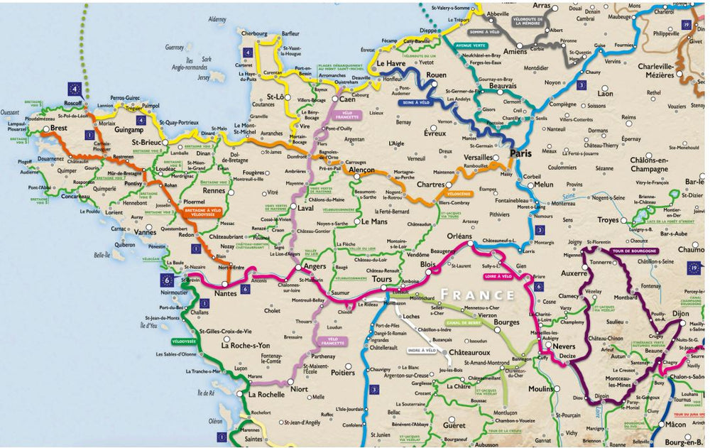
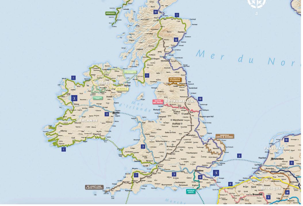
Map of cycle routes and greenways in Europe

Price
Regular price $12.00
Regular price Sale price $12.00
Save $-12
/
  • Shipping within 24 working hours from our warehouse in France
  • Delivery costs calculated instantly in the basket
  • Free returns (*)
  • Real-time inventory
  • In stock, ready to ship
  • Backordered, shipping soon
Tax included.

Often purchased together:

The complete medium- and long-distance cycle routes across Europe, with marked and labeled routes providing information on the main towns, cities, and villages crossed. A complete panorama of Europe by bike:

- The EuroVelo cycle network, comprising 19 routes specially designed for cycling. It allows you to visit 42 countries by bike over more than 70,000 km.

- The major national routes, using roads with low motorized vehicle traffic. Among the most emblematic are those located in France: Loire à Vélo, ViaRhôna, Canal des Deux Mers, Bretagne à Vélo, Tour de Bourgogne, VéloFrancette, etc.

- The main secure greenways, developed as dedicated lanes (independent of the road network) and reserved exclusively for use by soft transport.

Map created by cycle tourism experts and based on feedback from users of cycle routes and greenways.

Ideal for fans of slow tourism.


ISBN/EAN : 9782490795086
Publication date: 2023
Folded dimensions: 11 x 25cm
Unfolded dimensions: 110x100cm
Language(s): French English
Weight: 89 g

Customer Reviews

Based on 2 reviews
50%
(1)
50%
(1)
0%
(0)
0%
(0)
0%
(0)
G
Guy G. (Montreuil, FR)
voyage à vélo

Carte suffisante afin de se permettre une projection sur les principaux axes européens que l'on envisage de suivre.

C
Cécile D. (Lyon, FR)

Très bonne carte des routes européennes. Très bien pour préparer son projet de voyage vélo en Europe