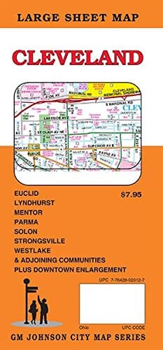
Cleveland, Ohio Street Map | GM Johnson carte pliée GM Johnson

Cleveland, Ohio Street Map | GM Johnson

Cleveland, Ohio Street Map | GM Johnson

Regular price $11.00
/
  • Ships within 48 business hours from our US warehouse.
  • Delivery costs calculated instantly in the basket
  • Free returns (*)
  • Real-time inventory
  • In stock, ready to ship
  • Backordered, shipping soon
Tax included.

Cleveland, Ohio Street Map Cuyahoga County, Geauga County, Lake County, Lorain County, Summit County, Bay Village, Beachwood, Bedford Heights, Bentleyville, Berea, Boston Heights, Bratenahl, Brecksville, Broadview Heights, Brook Park, Brooklyn, Brooklyn Heights, Chagrin Falls, Chardon, Cleveland, Cleveland Heights, Cuyahoga Heights, East Cleveland, Eastlake, Euclid, Fairview Park, Garfield Heights, Gates Mills, Glenwillow, Highland Heights, Highland Hills, Hunting Valley, Independence, Kirtland, Kirtland Hills, Lakewood, Linndale, Lyndhurst, Macedonia, Maple Heights, Mayfield, Mayfield Heights, Mentor, Mentor-On-The Lake, Middleburg Heights, Moreland Hills, Newburgh Heights, North Olmsted, North Randall, North Royalton, Northfield, Oakwood, Olmsted Falls, Orange, Painesville, Parma, Parma Heights, Pepper Pike, Richmond Heights, Rocky River, Seven Hills, Shaker Heights, Solon, South Euclid, South Russell, Strongsville, Timberlake, University Heights, Valley View, Waite Hill, Warrensvi


ISBN/EAN : 9781774490761
Publication date: 2021
Folded dimensions: 9 inches x 4 inches (22 x 10 cm)
Unfolded dimensions: 48 inches x 36 inches (121 x 91 cm)
Language(s): English
Poids : 0 g

Customer Reviews

Be the first to write a review
0%
(0)
0%
(0)
0%
(0)
0%
(0)
0%
(0)