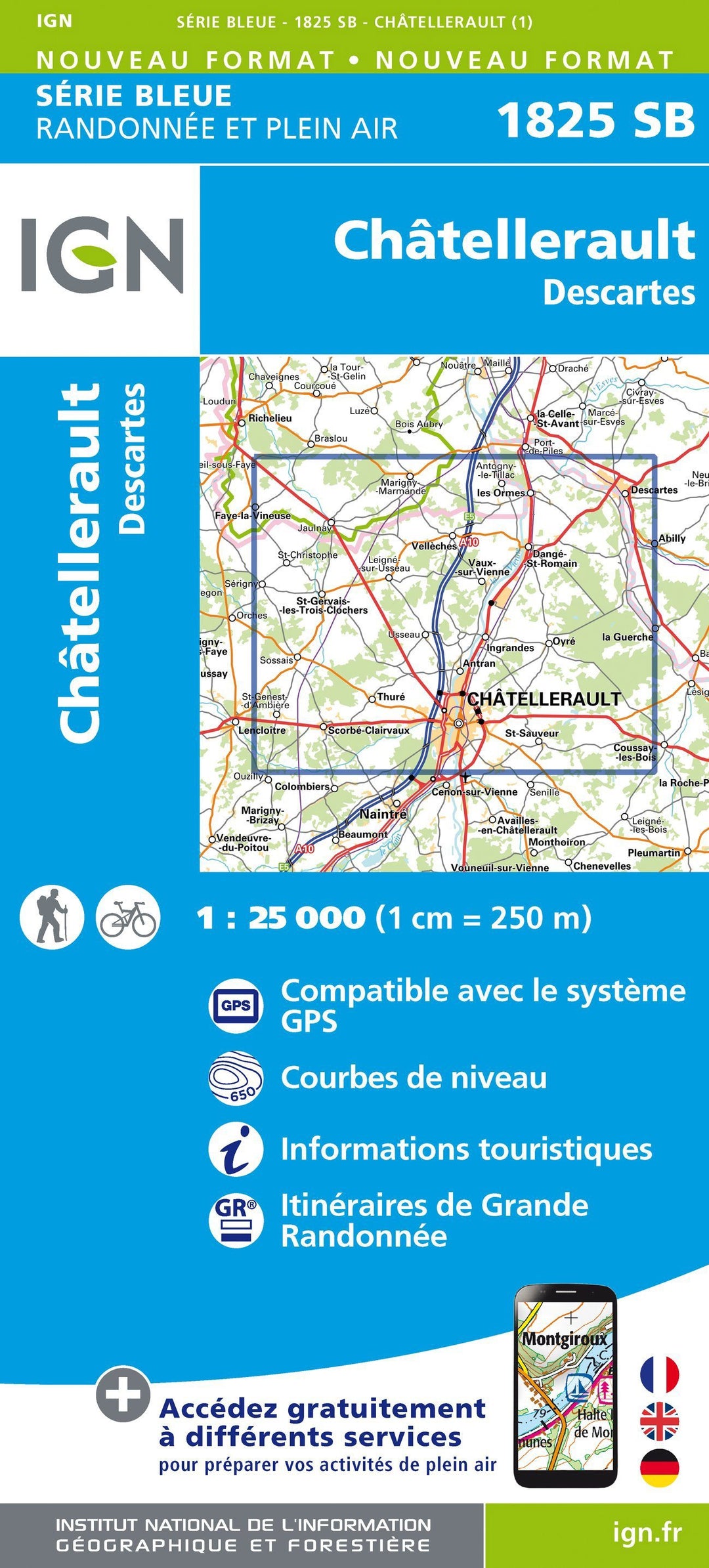
Hiking Map # 1825 - Châtellerault, Descartes | IGN - Blue Series

Carte de randonnée n° 1825 - Châtellerault, Descartes | IGN - Série Bleue carte pliée IGN

Hiking Map # 1825 - Châtellerault, Descartes | IGN - Blue Series

Regular price $16.00
/
  • Shipping within 24 working hours from our warehouse in France
  • Delivery costs calculated instantly in the cart
  • Free returns (*)
  • Real-time inventory
  • Low stock - 1 item left
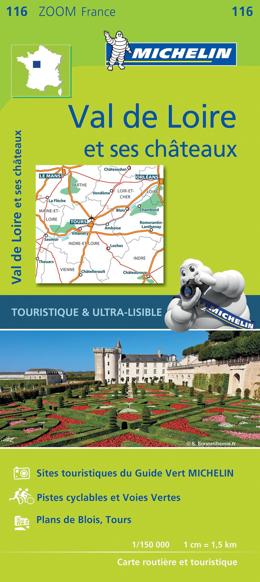
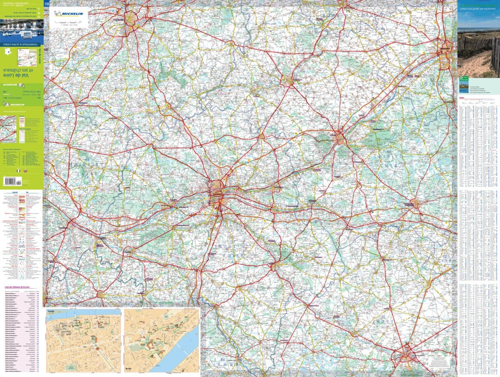
  • Inventory on the way
Tax included.

Often purchased together:

The indispensable hiking map! These topographic maps of a very high accuracy contain all existing details in the field: communication pathways to the slightest path, constructions to the hangar, wood, isolated tree, river, source ... without forgetting the representation of the relief by level curves.


ISBN/EAN : 9782758533139
Publication date: 2014
Scale: 1/25,000 (1cm=250m)
Folded dimensions: 22 x 11cm
Unfolded dimensions: 96cm x 132cm
Language(s): French, English, German
Poids : 89 g

Customer Reviews

No reviews yet
0%
(0)
0%
(0)
0%
(0)
0%
(0)
0%
(0)
More from Châtellerault
Carte routière n° 116 - Val de Loire et ses châteaux | Michelin carte pliée Michelin
Carte routière n° 116 - Val de Loire et ses châteaux | Michelin - Zoom France carte pliée Michelin
Road Map # 116 - Val de Loire and its castles | Michelin - Zoom France
Michelin
$10.00
Carte TOP 100 n° 139 - Poitiers, Châtellerault & PNR de la Brenne | IGN carte pliée IGN
Top 100 Map ° 139 - Poitiers, Châtellerault & PNR de la Brenne | IGN
IGN
$10.00
Carte de randonnée n° 1825 - Châtellerault, Descartes | IGN - Série Bleue carte pliée IGN
Hiking Map # 1825 - Châtellerault, Descartes | IGN - Blue Series
IGN
$16.00
Recently viewed