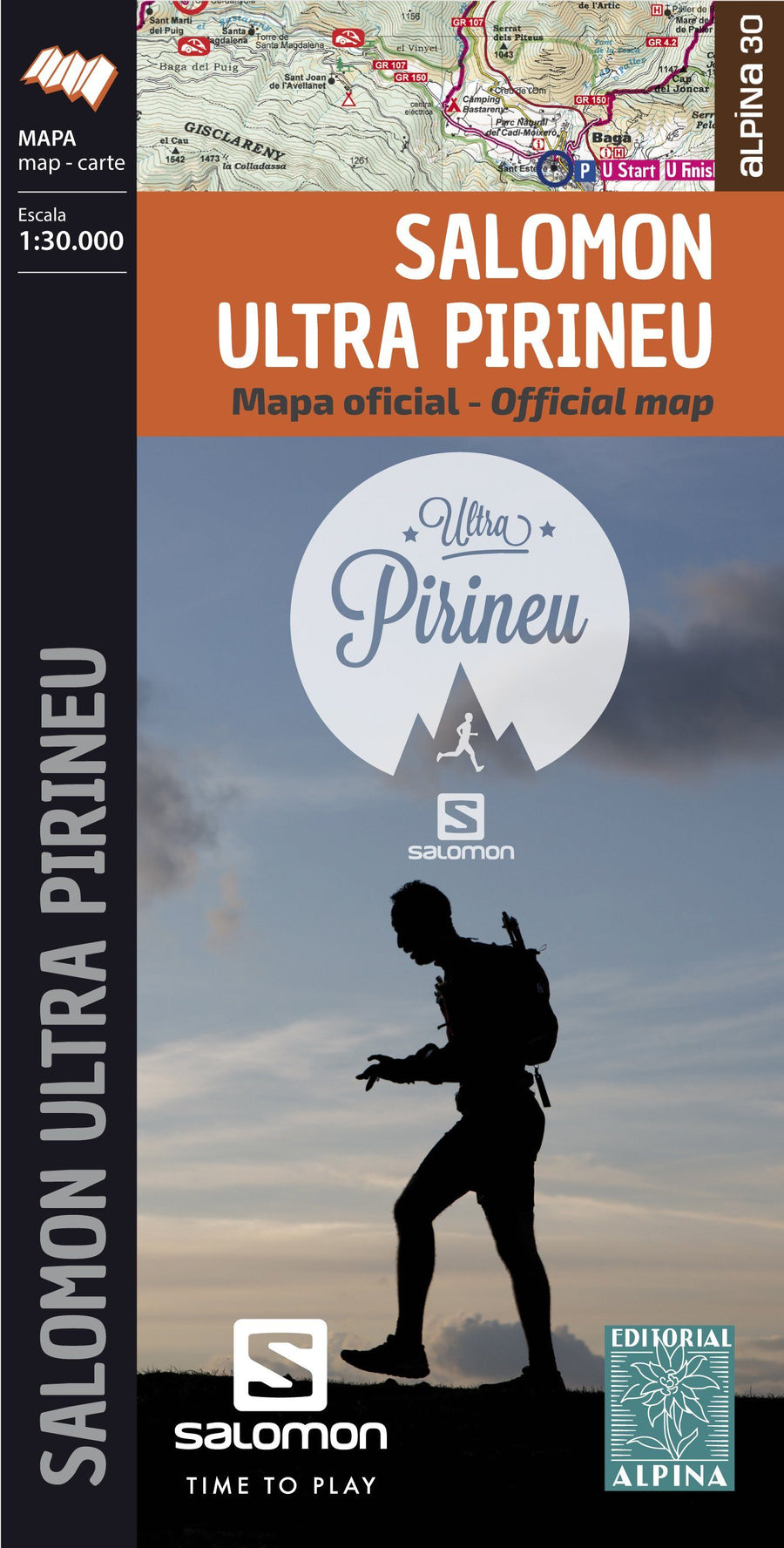
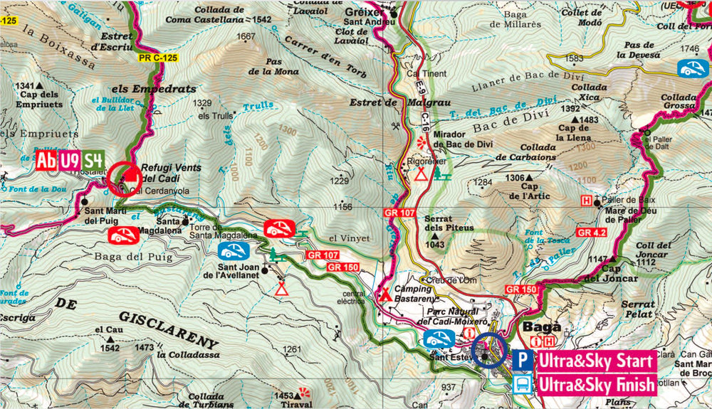
Racing Map - Salomon Ultra Pirineu (Catalan Pyrenees) | Alpina

Price
Regular price $13.00
Regular price Sale price $13.00
Save $-13
/
  • Shipping within 24 working hours from our warehouse in France
  • Delivery costs calculated instantly in the basket
  • Free returns (*)
  • Real-time inventory
  • Low stock - 2 item left
  • Backordered, shipping soon
Tax included.

Often purchased together:

Official Map of Solomon Ultra Pirineu , with backup stations, parking spaces, access, location of all the points of passage and the route of the five races: the ultra pirineu (94 km), the Pirineu trail (56 km), the Mitja Pirineu (19 km), the Nit Pirineu and the sky of Pirineu (36 km).


ISBN/EAN : 9788480907187
Publication date: 2019
Scale: 1/30,000 (1cm=300m)
Printed sides: front
Folded dimensions: 21 x 12.5cm
Language(s): English, Castilian, Catalan
Weight: 80 g

Customer Reviews

No reviews yet
0%
(0)
0%
(0)
0%
(0)
0%
(0)
0%
(0)
More from Catalonia
Carte routière n° 574 - Espagne nord-est (Catalogne, Aragon, Andorre) | Michelin carte pliée Michelin
Road map # 574 - Spain Northeast (Catalonia, Aragon, Andorra) | Michelin
Michelin
$10.00
Carte de randonnée - Parc National Aigüestortes & lac Saint-Maurice (Pyrénées catalanes) | Alpina carte pliée Editorial Alpina 2020
Carte de randonnée - Parc National Aigüestortes & lac Saint-Maurice + Guide (Catalogne) | Alpina carte pliée Editorial Alpina
Hiking map - Aigüestortes & Lake Saint - Maurice National Park (Catalan Pyrenees) | Alpina
Editorial Alpina
$20.00
Carte de randonnée du Massif des Albères & Côte Vermeille (Roussillon), n°11 | Rando Editions - La Compagnie des Cartes
Hiking map # 11 - Collioure, Cadaquès, Albères & Coast Vermeille (Roussillon) | Rando Editions (French)
Rando Editions
$17.00
New !
Lot de 2 cartes de randonnée - Pic d'Estats & Mont-Roig (Pyrénées catalanes) | Alpina carte pliée Editorial Alpina
Set of 2 hiking maps - Pic Estats & Mont - Roig (Catalan Pyrenees) | Alpina
Editorial Alpina
$20.00