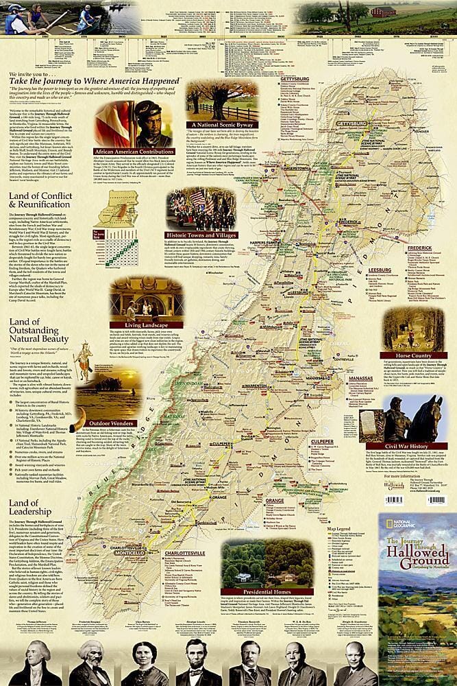
Take the journey to "where America happened" with National Geographic's Journey Through Hallowed Ground Map. This 180 - mile long, 75 - mile wide swath of land stretching from Gettysburg, Pennsylvania, to Monticello, Virginia, represents a remarkable historical and cultural landscape. Within it lies the single largest concentration of Civil War battle sites in the country, the homes and birthplaces of nine U.S. presidents including three of the first five, Native American settlements, thirteen national parks, and more. In addition to Civil War sites, this detailed map includes sites from the French and Indian War and Revolutionary War as well as points of interest from World War I and World War II history, and the struggle for civil rights.
The reverse side of the print map includes the US Civil war map, showing major land campaigns, Union and Confederate troop movements, major Union naval campaigns, roads, railroads, battle outcomes and their impacts on the war, dates of capture by Union forces and more. Two inset maps - Battle for the Capitals and Turning Points of the War - as well as a timeline of battles with map location, casualties and impacts of battles are included. Created with the assistance of the National Park Service, Civil War Preservation Trust, American Battlefield Protection Program, Naval Historical Center, Virginia War Museum, National Museum of Civil War Medicine, and the U.S. Naval Academy.
