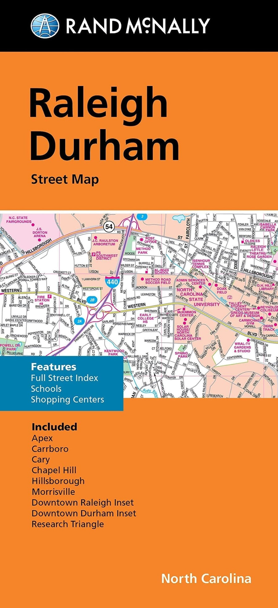
Rand McNally's folded map for Raleigh is a must - have for anyone traveling in and around this part of North Carolina, offering unbeatable accuracy and reliability at a great price. Our trusted cartography shows all Interstate, U.S., state, and county highways, along with clearly indicated parks, points of interest, airports, county boundaries, and streets. The easy - to - use legend and detailed index make for quick and easy location of destinations. You'll see why Rand McNally folded maps have been the trusted standard for years. •Regularly updated. •Full - color maps. •Clearly labeled Interstate, U.S., state, and county highways. •Indications of parks, points of interest, airports, county boundaries, downtown & vicinity maps. •Major attractions & Golf Courses. •Easy - to - use legend. •Detailed index & Major Street Index. •Convenient folded size. Coverage Area Communities Included: Apex, Carrboro, Cary, Chapel Hill, Hillsborough, Morrisville.
ISBN/EAN : 9780528025709
Publication date: 2021
Folded dimensions: 9.06 inches x 4.33 inches (23 x 10 cm)
Unfolded dimensions: 36.22 inches x 44.88 inches (91 x 113 cm)
Language(s): English
Weight:
3.0 oz


![Pisgah National Forest [Map Pack Bundle] | National Geographic carte pliée](http://mapscompany.com/cdn/shop/products/pisgah-national-forest-pack-de-cartes-national-geographic-carte-pliee-national-geographic-629650.jpg?v=1694456046&width=900)
![Pacific Crest Trail: California North [Map Pack Bundle] | National Geographic carte pliée](http://mapscompany.com/cdn/shop/products/pacific-crest-trail-california-north-map-pack-bundle-national-geographic-carte-pliee-national-geographic-272440.jpg?v=1694456970&width=900)