Hiking Map - Senda Pirenaica Gr11, Cabo Higer-Cap de Creus (Catalonia) | Alpina

Carte de randonnée - Senda Pirenaica GR11, Cabo Higer-Cap de Creus (Catalogne) | Alpina carte pliée Editorial Alpina

Hiking Map - Senda Pirenaica Gr11, Cabo Higer-Cap de Creus (Catalonia) | Alpina

Regular price $28.00
/
  • Shipping within 24 working hours from our warehouse in France
  • Delivery costs calculated instantly in the cart
  • Free returns (*)
  • Real-time inventory
  • In stock, ready to ship
  • Inventory on the way
Tax included.

Often purchased together:

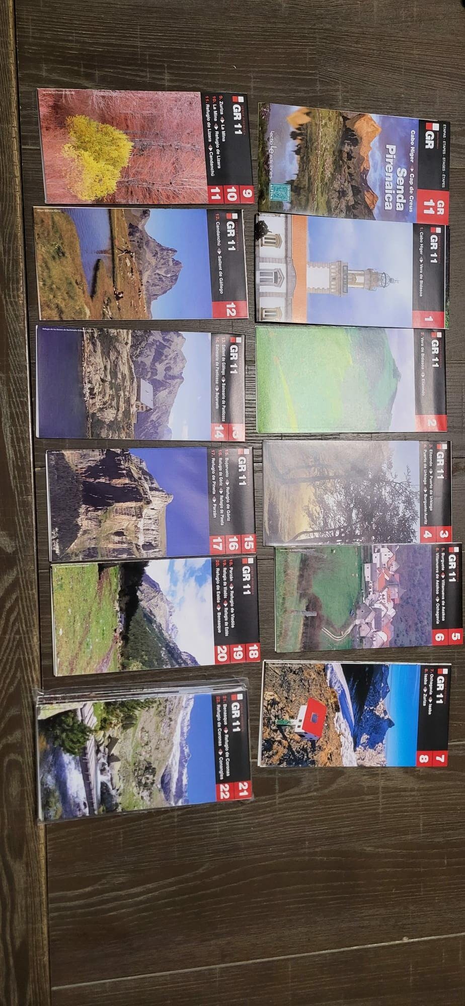
Full mapping of GR 11: from the Atlantic to the Mediterranean. The lot is composed of 21 topographic maps at 1:50 000 scale, which comprises the 43 steps of GR 11, with the technical sheet of each section, taking into account the two possible directions of the crossing, and with partial profiles of Each step.

21 Maps 1: 50.000 Including:
• 43 Steps
• Stage Profiles • Location of Shelters, Cottages, Campsites & Hotels
• Average Walking Time

The GR 11 (or the Senda) crosses the Pyrenees from one end to the other, from east to west, in Spanish territory, about 770 km, Cap de Creus in Cap du Figuier, in 40 stages . He crossed Catalonia, a little bit of Andorra, Aragon, Navarre and ends in Guzcoa. Foody hills from Piedmont, on trails and tracks, up to the high mountains in the stones, on the grass slopes and scree, all the floors of the mountain are arpened.
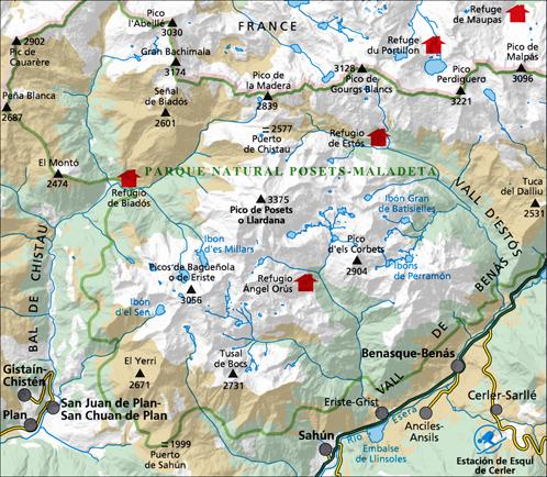
Catalan aridity, bushes and Liege oaks, monasteries under the sun. At Setcases opens the country of high collar. Then they are the embeds (the "Enchanted") and the innumerable lakes of the National Arc of Aigues Torn. The itinerary then lays down at the foot of the aneeto, then posets. Arrive Ordesa, exact Niscle and Mont-Lost: "Relentless beauty of nature, slow mirage of erosion, collision of the senses" according to the fervent words of P. Macia. The hiker then ventures into the Navarre of green rebounds, deep forests like the origins of the world. Finally, just before the ocean is the Guipuzcoa, the country of oaks, sources, payfish. With this crossing, you are dealing with one of the greatest adventures proposed by the European continent. Easier than the HRP, more sporty than the GR 10, the Senda will ask you more initiative, more instinct than its French cousin.


ISBN/EAN : 9788416918041
Publication date: 2017
Scale: 1/50,000 (1cm=500m)
Printed sides: front
Folded dimensions: 21 x 12.5cm
Unfolded dimensions: 98 x 68cm
Language(s): French, Castilian, Catalan
Poids : 170 g

Customer Reviews

Based on 6 reviews
100%
(6)
0%
(0)
0%
(0)
0%
(0)
0%
(0)
M
Mark A. (Ustaritz, FR)
Très bien, correspond à mes attentes

L'ensemble des cartes est très bien , pas encore utilisé sur le terrain c'est pour juin 2023 mais déjà très content de les avoir.

T
THIERRY G. (Poitiers, FR)

Livraison rapide le produit correspond à mon attente

H
Helen W. (Glasgow, GB)
Très bon rapport qualité/prix

Comprend l'intégralité du parcours du GR11 dans un format léger et compact à une échelle pratique. Excellent.

J
Jean-Bernard C. (Berson, FR)

Bon produit, fidèle à mes attentes.

I
Isabelle T. (Bordeaux, FR)
Parfait

Livraison rapide et les cartes correspondent à mon attente.

More from Cap de Creus
Sold Out
Le Guide Rando - Pyrénées Orientales : Canigou, Cerdagne, Capcir, Vallespir, Conflent, Cap Creus | Rando Editions guide de randonnée Rando Editions
The Rando - Pyrenees Guide is | Rando Editions (French)
Rando Editions
$20.00
Sold Out
Cartes & Guide de randonnée - Sender dels Pirineus - GR11, du Cap de Creus au Massíf de la Maladeta | Alpina carte pliée Editorial Alpina
Hiking Map - Porta del Cel | Alpina
Editorial Alpina
$34.00
Carte de randonnée - Senda Pirenaica GR11, Cabo Higer-Cap de Creus (Catalogne) | Alpina carte pliée Editorial Alpina
Hiking Map - Senda Pirenaica Gr11, Cabo Higer-Cap de Creus (Catalonia) | Alpina
Editorial Alpina
$28.00
Guide du Routard - Catalogne, Valence et sa région 2024/25 | Hachette guide de voyage Hachette
Guide du Routard - Catalonia, Valencia and its region 2021/22 | Hachette (French)
Hachette
$19.00
Carte de randonnée - Parc naturel du Cap de Creus (Catalogne) | Alpina carte pliée Editorial Alpina
Hiking Map - Cap de Creus Natural Park (Catalonia) | Alpina
Editorial Alpina
$17.00
Recently viewed