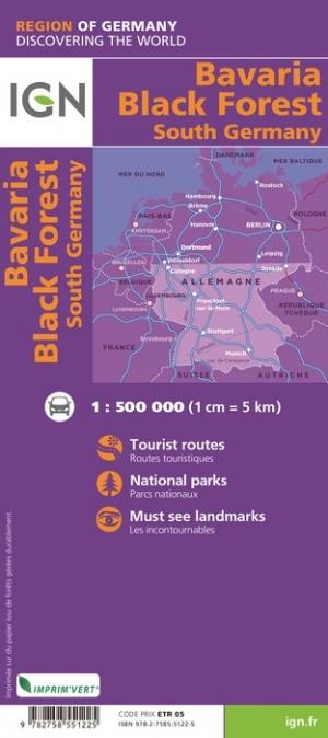
Road Map # 131 - Black Forest & Alsace | Michelin - Zoom France (French)

Carte routière n° 131 - Forêt Noire & Alsace | Michelin carte pliée Michelin
Carte routière n° 131 - Forêt Noire & Alsace | Michelin - Zoom France carte pliée Michelin
Carte routière n° 131 - Forêt Noire & Alsace | Michelin carte pliée Michelin

Road Map # 131 - Black Forest & Alsace | Michelin - Zoom France (French)

Regular price $10.00
/
  • Shipping within 24 working hours from our warehouse in France
  • Delivery costs calculated instantly in the cart
  • Free returns (*)
  • Real-time inventory
  • In stock, ready to ship
  • Inventory on the way
Tax included.

Often purchased together:

Detailed road map of the Black Forest and Alsace. This detailed map extends from Wissembourg to Switzerland (from north to south) and St Dié des Vosges in Tübingen (from West East) and covers the regions of Strasbourg and Mulhouse.

In inset, Basel plans, Colmar, Mulhouse, Strasbourg ...

Distances shown on the map and index of cities included. Indication of tourist attractions, bike paths and greenways. Scale 1: 200,000 (1 cm = 2 km).


ISBN/EAN : 9782067209879
Publication date: 2019
Scale: 1/200,000 (1cm=2km)
Printed sides: front
Folded dimensions: 11 x 25cm
Unfolded dimensions: 143 x 100cm
Language(s): French
Poids : 89 g

Customer Reviews

Based on 4 reviews
100%
(4)
0%
(0)
0%
(0)
0%
(0)
0%
(0)
H
Hervé B. (Montcaret, FR)
Produit conforme

Produit conforme à mes attentes (le savoir-faire Michelin est là ...)
Seul bémol; le surlignage des localités en violet rend la visibilité difficile

J
JEAN-CLAUDE S. (Westhalten, FR)
Carte routière

Très bonne carte Michelin pour l'Alsace et la Forêt Noire.

A
Abrassart M. (Quaregnon, BE)
carte routière

carte routière Michelin.
Très complète et très lisible.
Plan des grandes villes en annexe.
De quoi barouder en Alsace et en Forêt Noire sans tracas.

T
Thierry L.C. (Rennes, FR)
Très bonne carte

Parfaite pour visiter la Forêt Noire. Toutes les routes y figurent de façon lisible avec en plus des indications touristiques.

More from Bâle
Carte topographique n° 102 - Basel, Luzern (Suisse) | Swisstopo - 1/100 000 carte pliée Swisstopo
Topographic Map # 102 - Basel, Luzern (Switzerland) | Swisstopo - 1/100 000
Swisstopo
$28.00
Carte de randonnée n° 213T - Basel (Suisse) | Swisstopo - Excursions au 1/50 000 carte pliée Swisstopo
Carte de randonnée imperméable n° 213T - Basel (Suisse) | Swisstopo - Excursions au 1/50 000 carte pliée Swisstopo
Hiking Map # 213T - Basel (Switzerland) | SwissTopo - Excursions to 1/50 000
Swisstopo
$25.00
Carte topographique n° 1047 - Bâle (Suisse) | Swisstopo - 1/25 000 carte pliée Swisstopo
Carte de randonnée n° 1047 - Bâle (Suisse) | Swisstopo - 1/25 000 carte pliée Swisstopo
Hiking Map # 1047 - Basel (Switzerland) | Swisstopo - 1/25 000
Swisstopo
$16.00
Carte de randonnée n° 212 - Boncourt (Suisse) | Swisstopo - 1/50 000 carte pliée Swisstopo
Topographic Map # 212 - Boncourt (Switzerland) | Swisstopo - 1/50 000
Swisstopo
$16.00
Sold Out
Guide vélo - Eurovélo 6, de Bâle à Nevers | Chamina guide vélo Chamina
Guide vélo - Eurovélo 6, de Bâle à Nevers | Chamina guide petit format Chamina
Cycling Guide - Eurovélo 6, from Basel to Nevers | Chamina (French)
Chamina
$17.00
Recently viewed