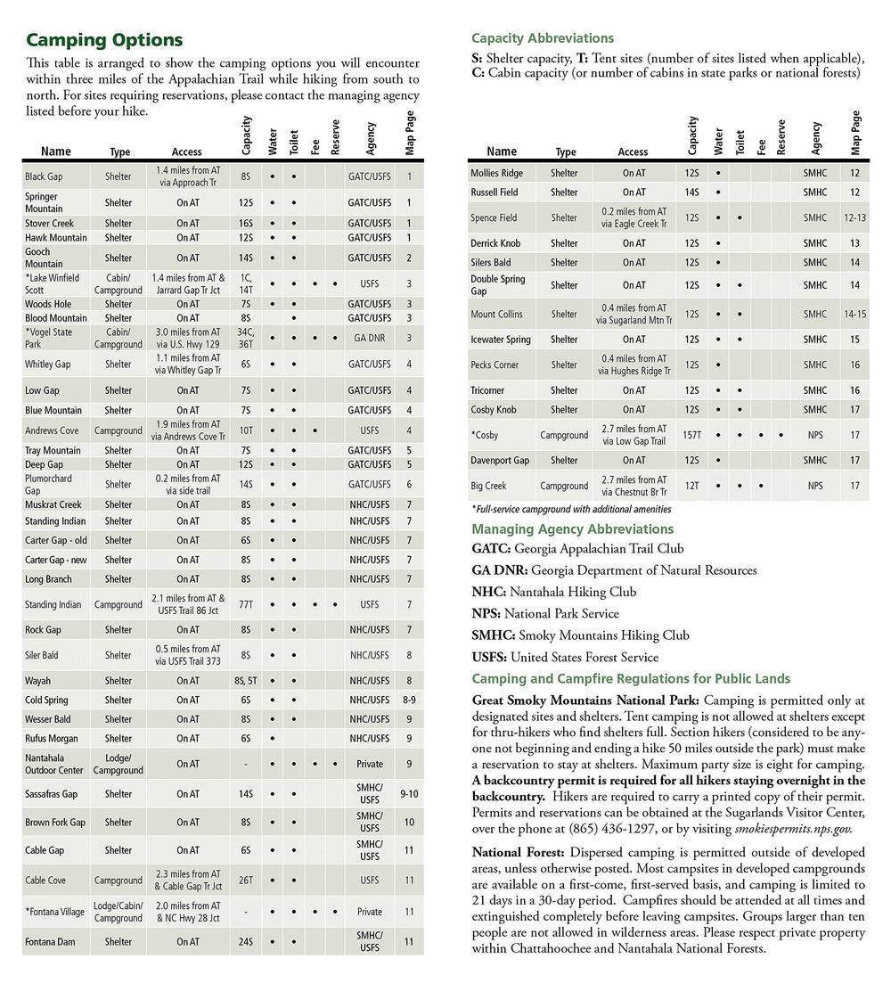
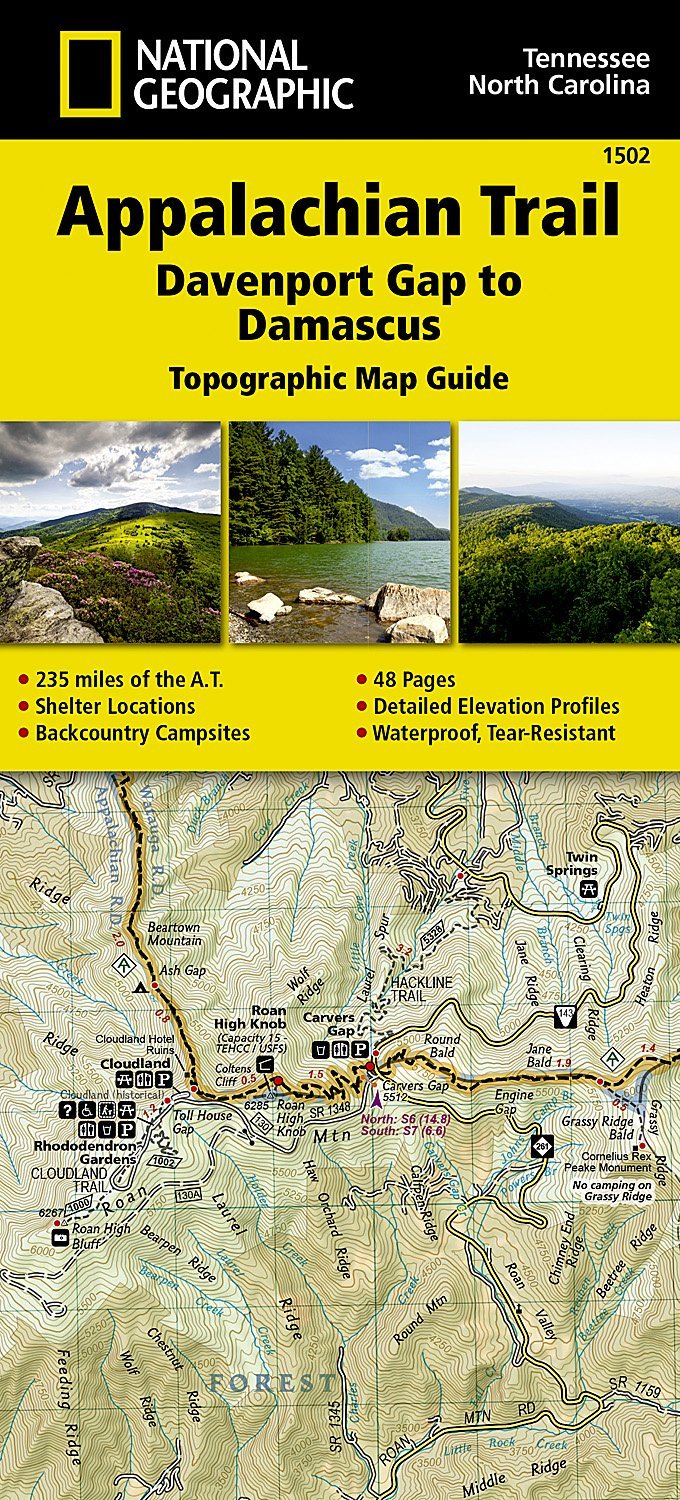
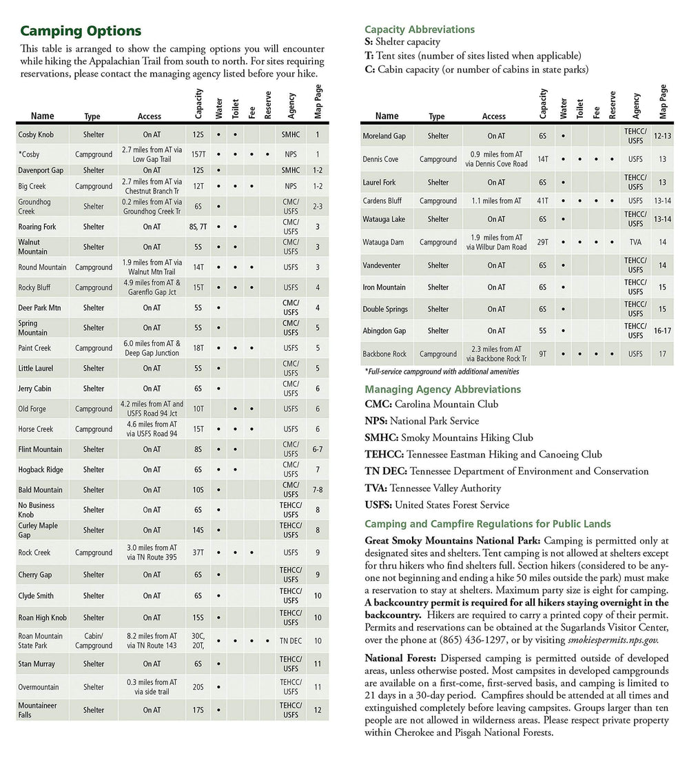
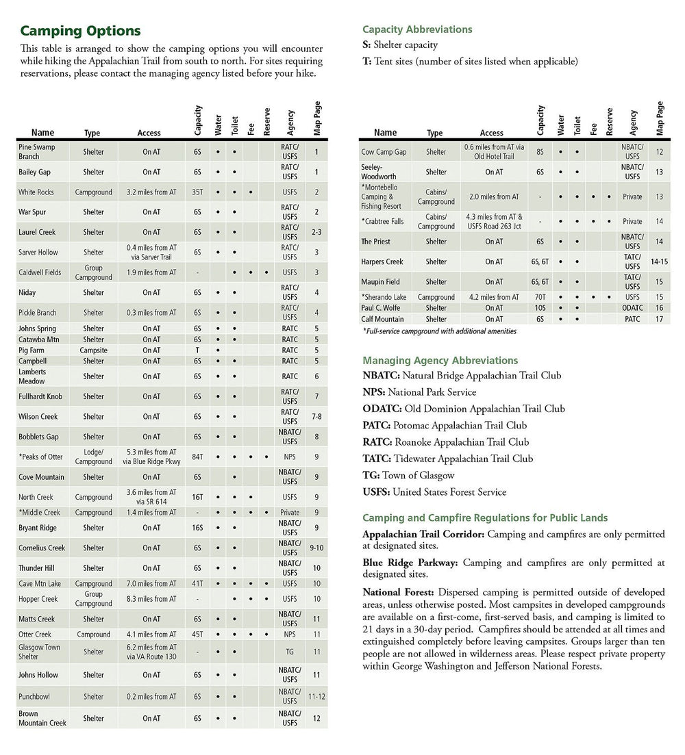
Hiking Map of the Appalachian Trail - SPRINGER MT TO DAVENPORT GAP - # 1501 | National Geographic

Carte de randonnée de l'Appalachian Trail - Springer Mt to Davenport Gap - n° 1501 | National Geographic carte pliée National Geographic

Hiking Map of the Appalachian Trail - SPRINGER MT TO DAVENPORT GAP - # 1501 | National Geographic

Regular price $18.00
/
  • Shipping within 24 working hours from our warehouse in France
  • Delivery costs calculated instantly in the cart
  • Free returns (*)
  • Real-time inventory
  • In stock, ready to ship
  • Inventory on the way
Tax included.

Often purchased together:

Topographic Map of a portion of the Appalachian Trail (Georgie, North Carolina and Tennessee). Contour line. Indication of trekking paths, places of accommodation (campsites), bases of Rangers. Detailed waterproof and tearing resistant map. Scale 1/63 360 (1 cm = 633 m).


ISBN/EAN : 9781597756389
Publication date: 2015
Scale: 1/63360 (1cm=633m)
Printed sides: both sides
Folded dimensions: 23.5 x 10.9cm
Language(s): English
Poids : 89 g

Customer Reviews

No reviews yet
0%
(0)
0%
(0)
0%
(0)
0%
(0)
0%
(0)
Recently viewed