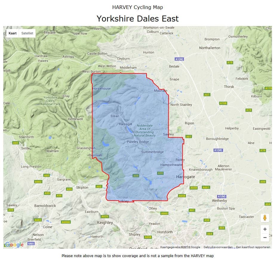
Carte cycliste - Dales Est, Pateley Bridge & Nidderdale | Harvey Maps - Cycling maps carte pliée Harvey Maps

Cycling Map - Dales East, Pateley Bridge & Nidderdale | Harvey Maps - Cycling maps

Cycling Map - Dales East, Pateley Bridge & Nidderdale | Harvey Maps - Cycling maps

Regular price $12.00
/
  • Shipping within 24 working hours from our warehouse in France
  • Delivery costs calculated instantly in the basket
  • Free returns (*)
  • Real-time inventory
  • Low stock - 1 item left
  • Backordered, shipping soon
Tax included.
Waterproof maps with tracks and infrastructure to cycle and mountain bike.
Off-road cycling maps and mountain biking.


Features:
Includes Recommended Cyclists Itineraries, Points of Access, Rights and Preferential Itineraries
Contains information about facilities and services.


ISBN/EAN : 9781851374601
Publication date: 2003
Scale: 1/40,000 (1cm=400m)
Folded dimensions: 12.8 x 24.5cm
Language(s): English
Poids : 82 g

Customer Reviews

No reviews yet
0%
(0)
0%
(0)
0%
(0)
0%
(0)
0%
(0)