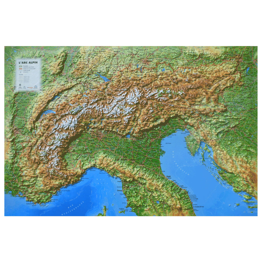
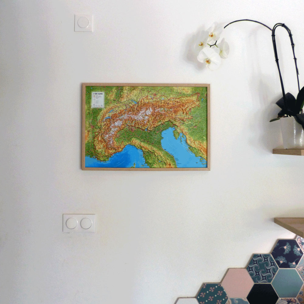
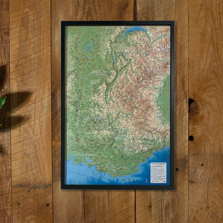
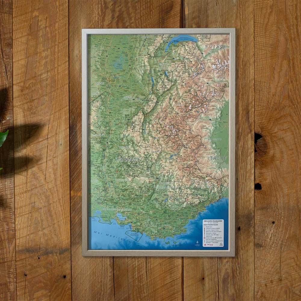
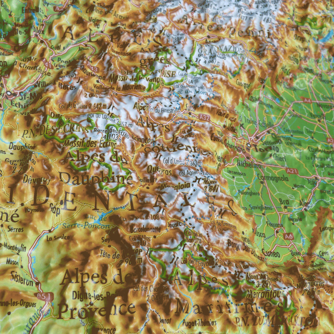
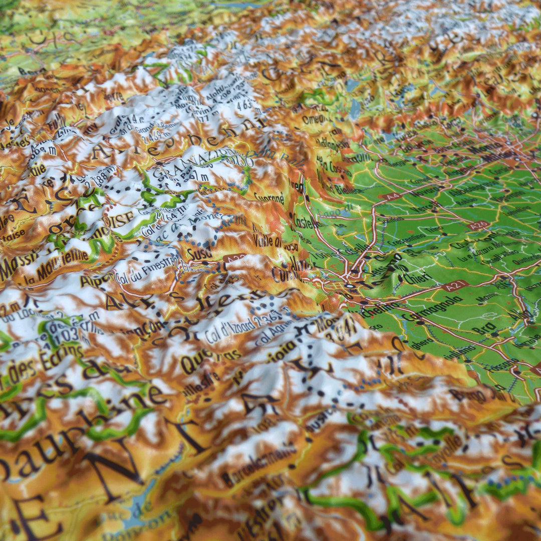
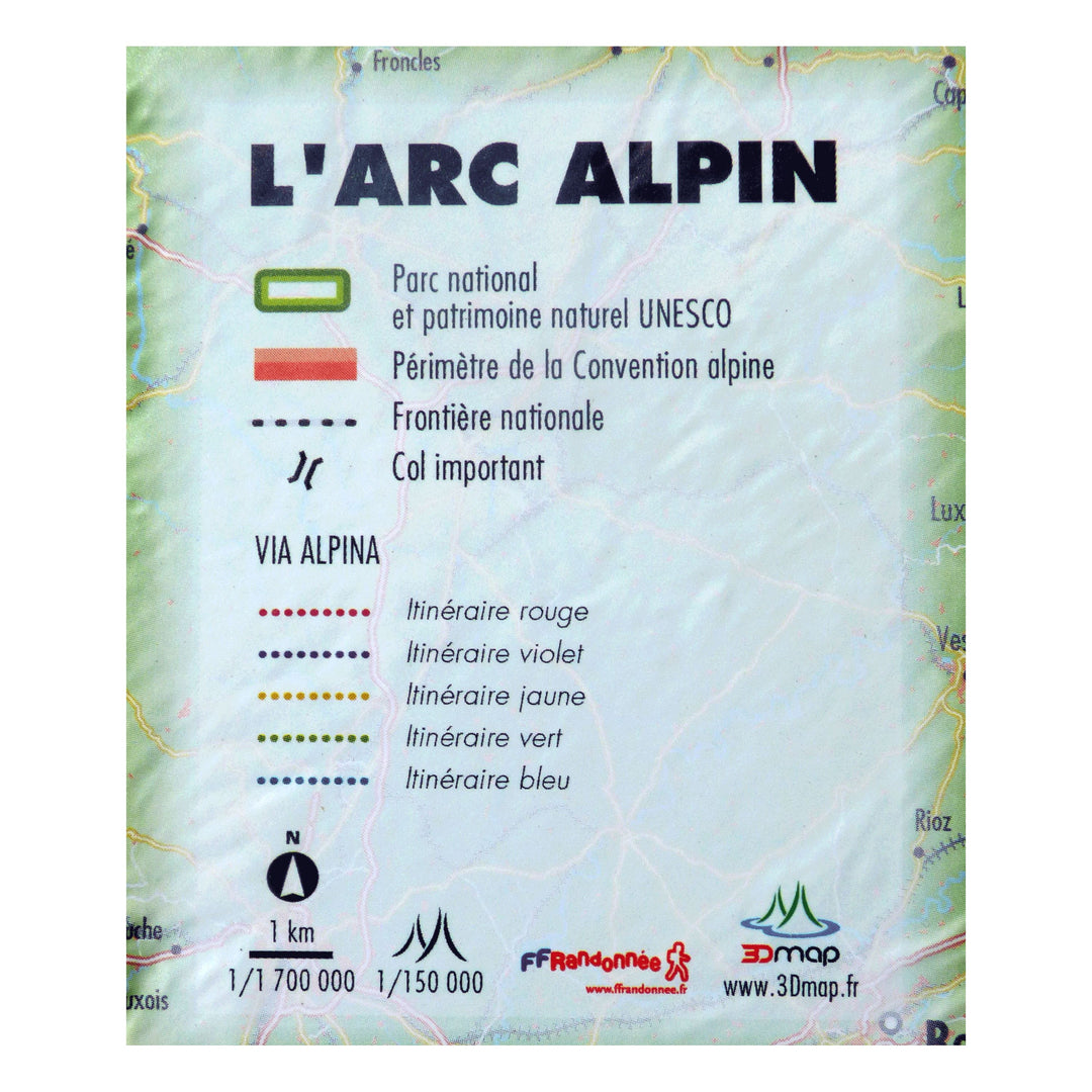
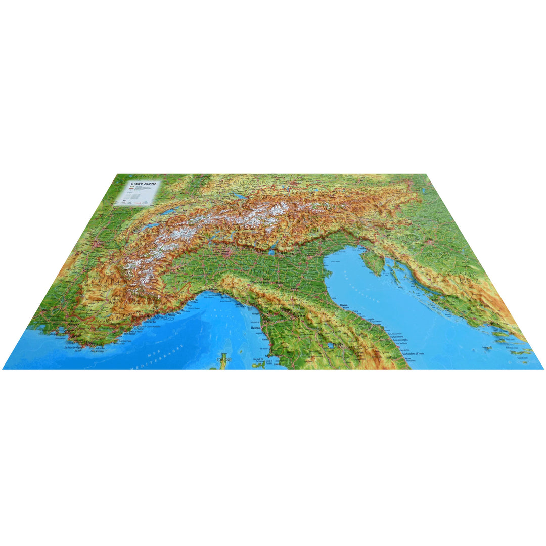
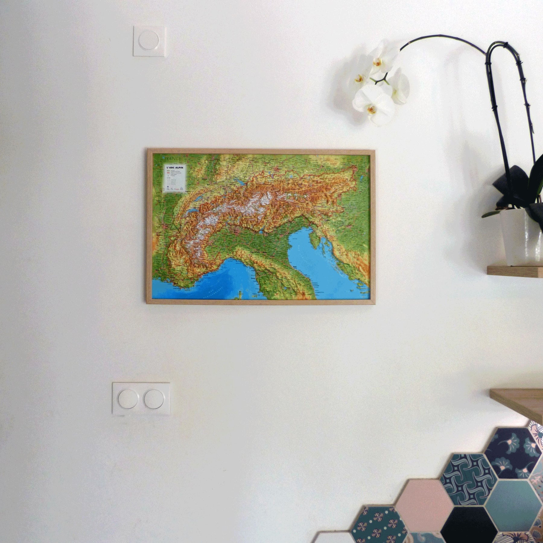
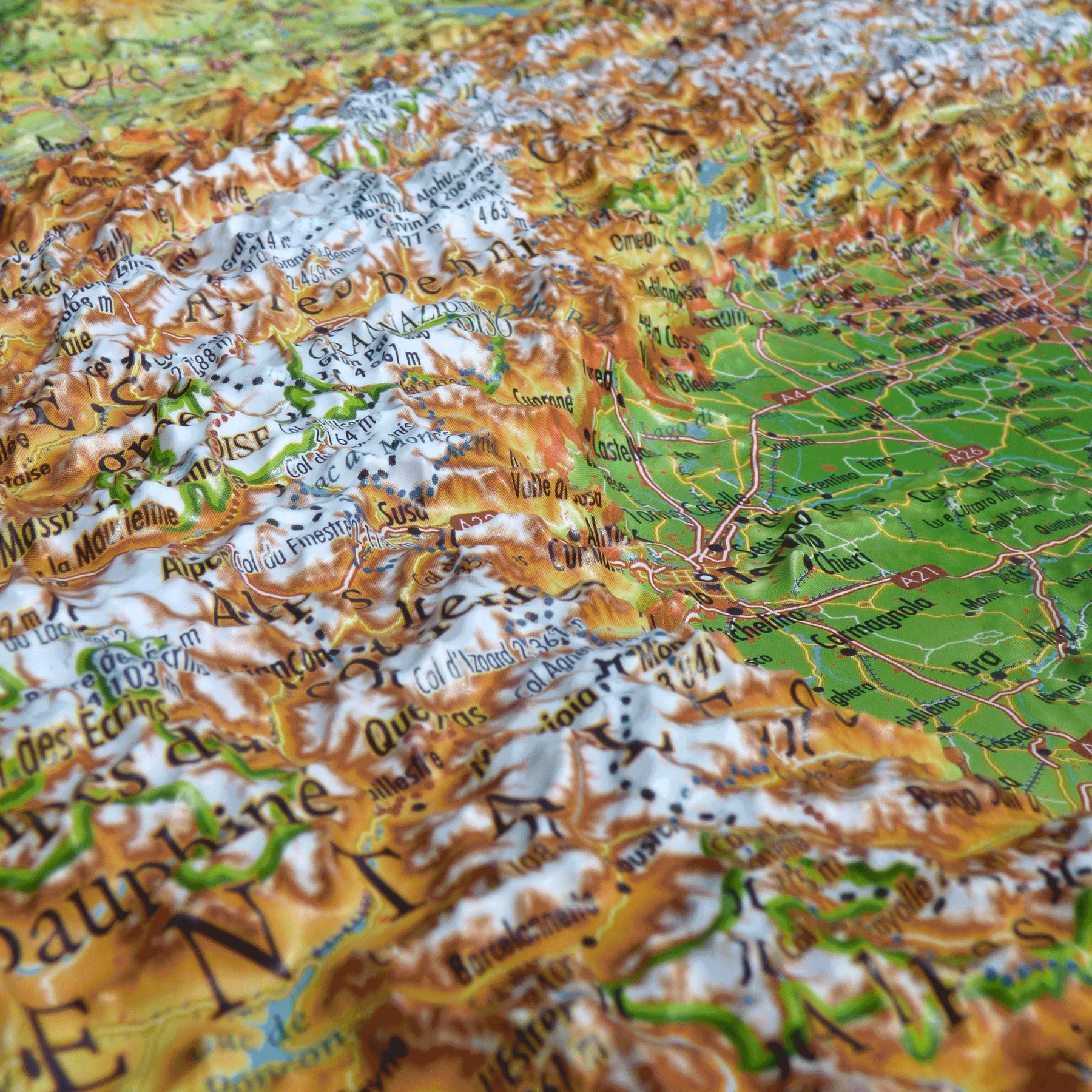
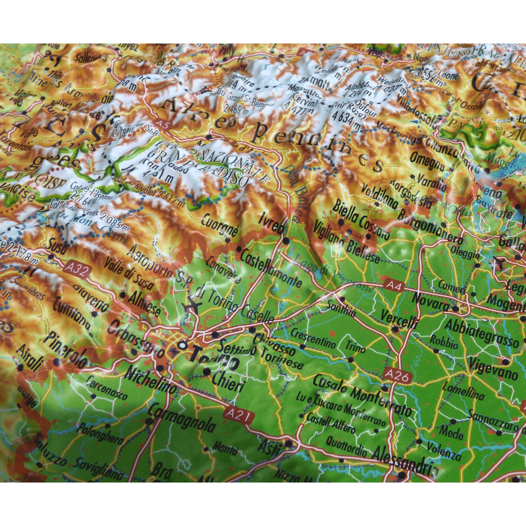
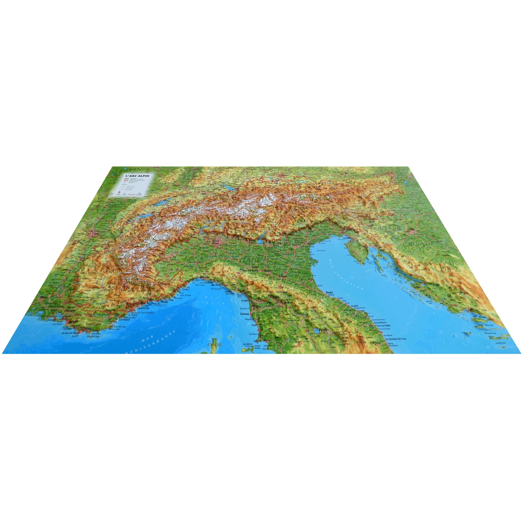
Relief wall map - Alpine Arc - 61 cm x 41 cm | 3D Map

Price
Regular price $48.00
Regular price Sale price $48.00
Save $-48
/
  • Shipping within 24 working hours from our warehouse in France
  • Delivery costs calculated instantly in the basket
  • Real-time inventory
  • Low stock - 1 item left
  • Backordered, shipping soon
Tax included.

Often purchased together:

Relief wall map covering the entire Alpine arc.

A finishing frame is also available as an option: We strongly recommend it to facilitate hanging and enhance your map.

Information included on the map:

- General data:

  • Hydrological, natural and hypsometric data, administrative data, national borders

- Tourist attractions:

  • National Park and UNESCO Natural Heritage Site

- Sports and hiking sites:

  • Alpine Convention Area
  • Major passes
  • VIA ALPINA: Red Route, Purple Route, Yellow Route, Green Route, Blue Route

- Map scale: 1:1,700,000

- Elevation scale: 1:150,000


ISBN / EAN : 9791097206437
Date de publication : 2023
Echelle : 1/650,000 (1cm=6.5km)
Dimensions déplié(e) : 41cm x 61cm
Langue : French
Poids : 136 g

Customer Reviews

Be the first to write a review
0%
(0)
0%
(0)
0%
(0)
0%
(0)
0%
(0)