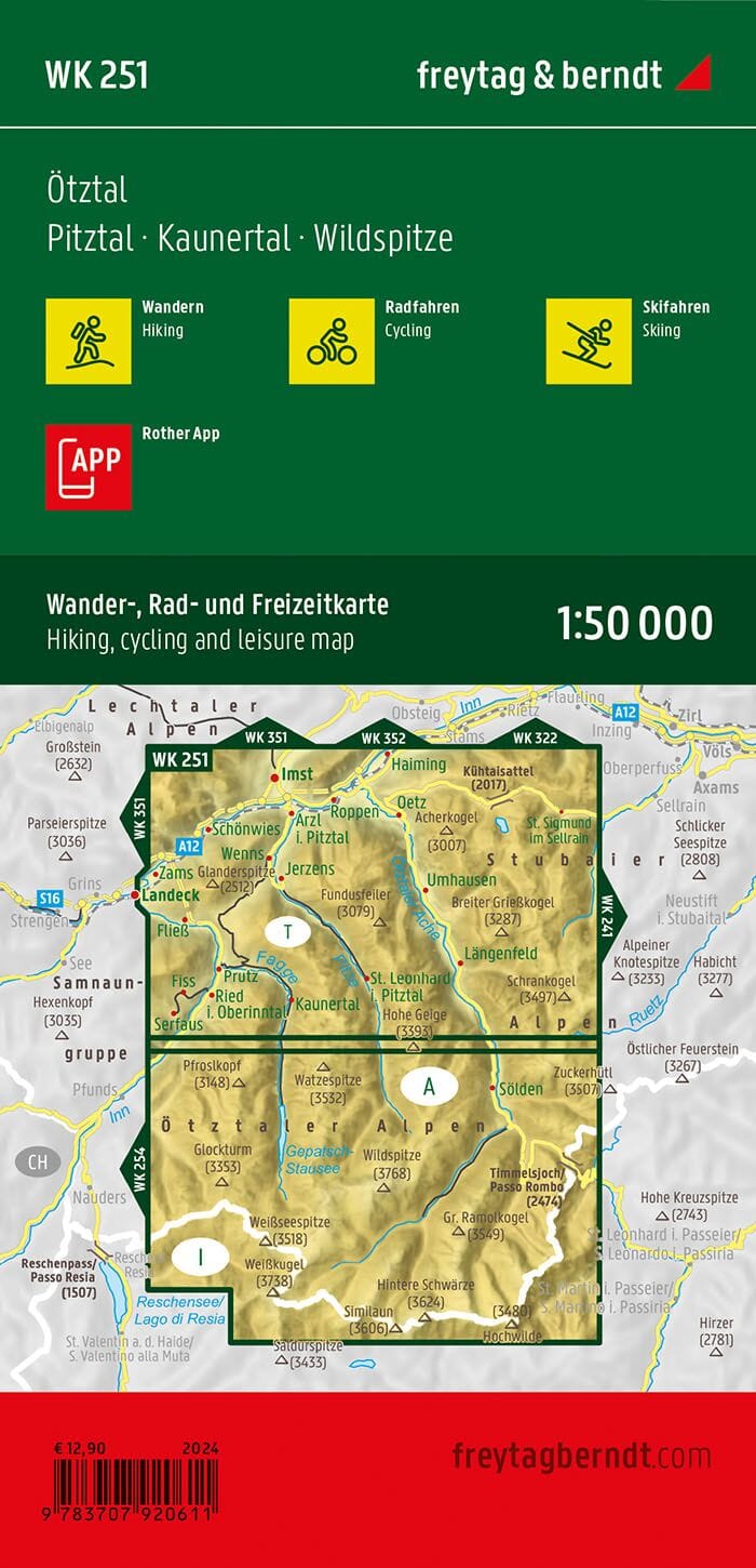
Hiking map - Traunradweg - Wels & Umgeb. - Bad Hall - Hausruck (Austrian Alps), No. WK054 | Freytag & Berndt

Price
Regular price $16.00
Regular price Sale price $16.00
Save $-16
/
  • Shipping within 24 working hours from our warehouse in France
  • Delivery costs calculated instantly in the basket
  • Free returns (*)
  • Real-time inventory
  • Low stock - 1 item left
  • Backordered, shipping soon
Tax included.

Often purchased together:

Hiking and cycling map with information on the terrain and points of interest. The accompanying information booklet contains a selection of the best hiking trails, cycling paths, and mountain bike trails, as well as a brief description of the individual municipalities and their leisure activities. (Language: German).


ISBN/EAN : 9783707917642
Publication date: 2019
Folded dimensions: 20.5 x 12.5cm
Language(s): German English
Weight: 110 g

Customer Reviews

Be the first to write a review
0%
(0)
0%
(0)
0%
(0)
0%
(0)
0%
(0)