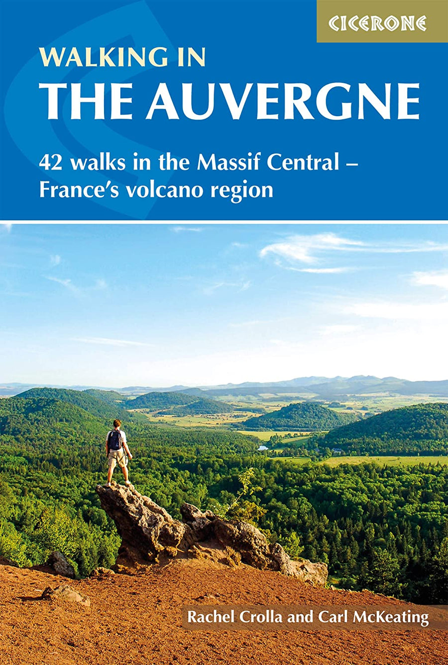
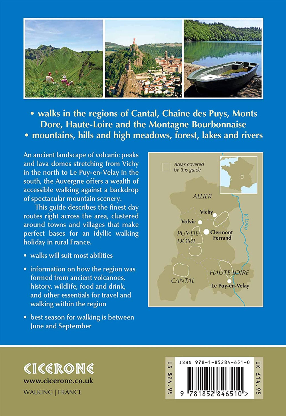
Hiking guide - Auvergne: 42 WALKS IN VOLCANIC HILLS OF FRANCE | Cicerone

Guide de randonnées (en anglais) - Auvergne : 42 walks in volcanic hills of France | Cicerone guide de randonnée Cicerone

Hiking guide - Auvergne: 42 WALKS IN VOLCANIC HILLS OF FRANCE | Cicerone

Regular price $22.00
/
  • Shipping within 24 working hours from our warehouse in France
  • Delivery costs calculated instantly in the cart
  • Free returns (*)
  • Real-time inventory
  • In stock, ready to ship
  • Inventory on the way
Tax included.

Often purchased together:

Topoguide of the Cicerone publisher with detailed records for hiking in Auvergne.

Description provided by the publisher:
Guidebook to the Auvergne Describing 42 Walks Between 5 and 20 km in the Quiet Volcanic Hills of Central France. Five Areas Area Covered: Cantal, Chain des Puys, Mount Doores, Haute-Loire and Montagne Bourbonnaise. The Volcanic Geography Provides a Stunning Backdrop to Suitable Roads for All Walkers. Basics in Vichy, Clermont-Ferrand and Puy-en-Velay.
Seasons: All The Routes Can Be Enjoyed from May to October. The Summer Months are Usually Hot and Sunny, Purpose The Winters See Snowbound Villages and Skiing on the Higher Auvergne Peaks.
Centers: Cities: Puy-en-Velay and Vichy Villages: ORCIVAL FOR THE MONTS DORE AND DOMES, MURAT FOR THE CANTAL, MAYET-DE-MOUNTAIN FOR THE BOURBONNE.
Difficulty: Grade 1: Short Easy Walks with FEW Navigational Problems and Little Ascent Grade 2: WALKS THAT WILL NOT BE TAXING FOR A FIT AND EXPERIENCIED HIKER. They may be running, Have Moderate Height Gain Gor Require Good Navigation Skills Grade 3: Challenging Walks for Experienced Hikers. Steep Land May Be Encountered With Considerable Ascent Gold Longer Mountain Days.
MUST SEE: Fascinating Volcanoes: Puy de Dome, Cow and Pariou High Summits: Cantal lead, Puy Mary and Puy de Sancy Magnificent Abbeys and Churches: Chair God, Lavaudieu and Orcival Chateaux: Montgilbert and Lavoûte-sur-Loire Attractive Basics: The Puy-en-Velay and Vichy Lakes Guery and Pavin, The Grand Cascade and Volvic Spring.


ISBN/EAN : 9781852846510
Publication date: 2013
Folded dimensions: 12 x 17cm
Language(s): English
Poids : 306 g

Customer Reviews

No reviews yet
0%
(0)
0%
(0)
0%
(0)
0%
(0)
0%
(0)
Carte départementale D03-63 - Allier & Puy de Dôme | IGN carte pliée IGN
Departmental Map D03-63 - Allier & Dome Puy | IGN
IGN
$7.00
Carte routière n° 709 - 1/4 France - Sud-Est 2024 | Michelin carte pliée Michelin
Carte routière n° 709 - France Sud-Est 2023 | Michelin carte pliée Michelin
Road map n° 709 - 1/4 France - South-East 2024 | Michelin
Michelin
$7.00
Carte routière n° 706 - France Nord-Ouest 2024 | Michelin carte pliée Michelin
Road map n° 706 - 1/4 France - North-West 2024 | Michelin
Michelin
$7.00
Sold Out
Carte routière n° 708 - 1/4 France - Sud-Ouest 2024 | Michelin carte pliée Michelin
Carte routière n° 708 - France Sud-Ouest 2023 | Michelin carte pliée Michelin
Road map n° 708 - 1/4 France - South-West 2024 | Michelin
Michelin
$7.00
Carte routière - France Nord-Est | IGN carte pliée IGN
Road Map - France Northeast | IGN
IGN
$7.00
Recently viewed